MyTopo
Barneston Nebraska US Topo Map
Couldn't load pickup availability
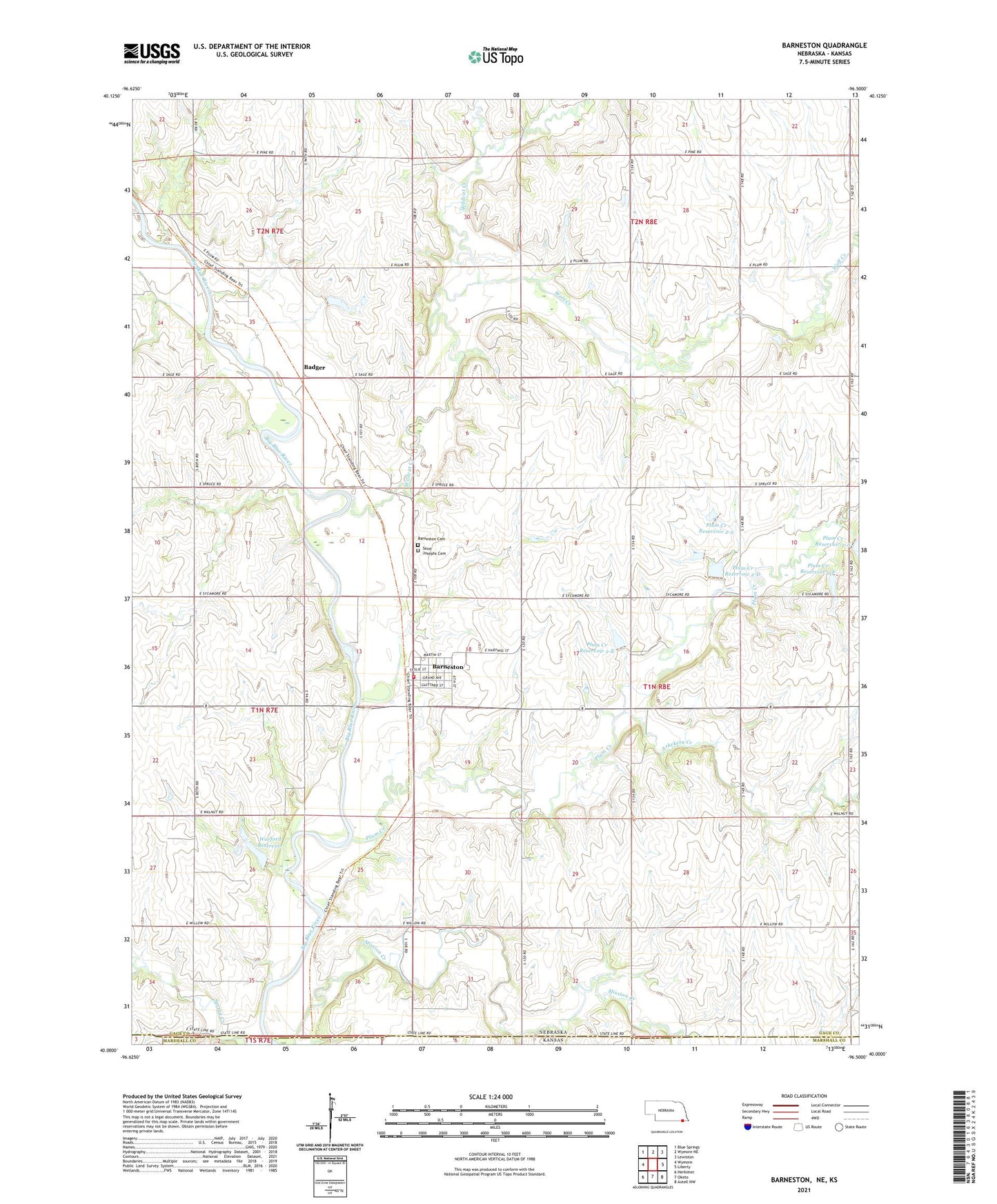
2021 topographic map quadrangle Barneston in the states of Nebraska, Kansas. Scale: 1:24000. Based on the newly updated USGS 7.5' US Topo map series, this map is in the following counties: Gage, Marshall. The map contains contour data, water features, and other items you are used to seeing on USGS maps, but also has updated roads and other features. This is the next generation of topographic maps. Printed on high-quality waterproof paper with UV fade-resistant inks.
Quads adjacent to this one:
West: Wymore
Northwest: Blue Springs
North: Wymore NE
Northeast: Lewiston
East: Liberty
Southeast: Axtell NW
South: Oketo
Southwest: Herkimer
This map covers the same area as the classic USGS quad with code o40096a5.
Contains the following named places: Arkeketa Creek, Badger, Barneston, Barneston Cemetery, Barneston Post Office, Barneston Power Plant Dam, Barneston Power Plant Reservoir, Barneston Rural Volunteer Fire Department, Barneston School, Farmers Co-operative Elevator, Mission Creek, Oto and Missouri Agency Historical Marker, Plum Creek Dam 2-2, Plum Creek Dam 2-A, Plum Creek Dam 2-D, Plum Creek Dam 2-E, Plum Creek Dam 2-F, Plum Creek Reservoir 2-2, Plum Creek Reservoir 2-D, Plum Creek Reservoir 2-E, Plum Creek Reservoir 2-F, Saint Joseph Catholic Church, Saint Josephs Cemetery, Township of Liberty, Village of Barneston, Warford Dam, Warford Reservoir, Wildcat Creek, Wolf Creek, ZIP Code: 68309