MyTopo
Lexington East Nebraska US Topo Map
Couldn't load pickup availability
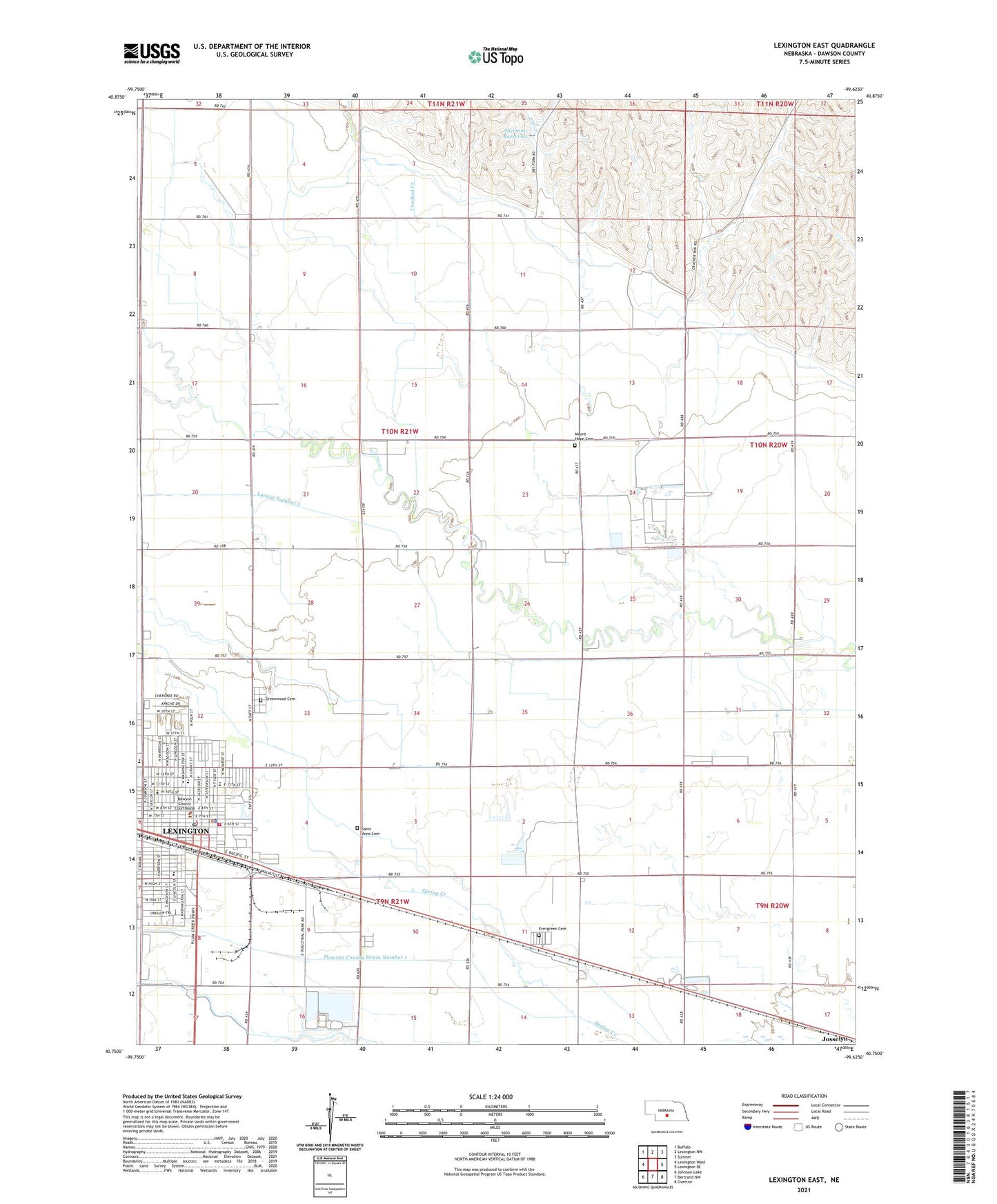
2021 topographic map quadrangle Lexington East in the state of Nebraska. Scale: 1:24000. Based on the newly updated USGS 7.5' US Topo map series, this map is in the following counties: Dawson. The map contains contour data, water features, and other items you are used to seeing on USGS maps, but also has updated roads and other features. This is the next generation of topographic maps. Printed on high-quality waterproof paper with UV fade-resistant inks.
Quads adjacent to this one:
West: Lexington West
Northwest: Buffalo
North: Lexington NW
Northeast: Sumner
East: Lexington SE
Southeast: Overton
South: Bertrand NW
Southwest: Johnson Lake
Contains the following named places: Arbor Park, Berean Fundamental Church, Berquist Lateral, Bryan School, Calvary Assembly of God Church, Church of Christ, City of Lexington, Crooked Creek, Dawson County Courthouse, Dawson County Fairgrounds, Dawson County Historical Museum, Dawson County Sheriff's Office, DeBruce Grain Incorporated Elevator, Donald Price Mobile Home Park, Evangelical Free Church, Evergreen Cemetery, First Baptist Church, First Presbyterian Church, First United Methodist Church, French Creek, Gable View Inn Campground, Grace Lutheran Church, Grant Election Precinct, Greenwood Cemetery, Lateral Number 2, Lexington, Lexington High School, Lexington Middle School, Lexington Police Department, Lexington Post Office, Lexington Public Library, Lexington Volunteer Fire Department, Memorial Park, Morton School, Mount Hope Cemetery, Northside Church of Christ, Oak Park, Pershing School, Pioneer Park, Plum Creek Care Center, Plum Creek Memorial Wall, Prairie View Estates, Saint Anns Catholic Church, Saint Anns Cemetery, Saint Anns School, Saint Peters Episcopal Church, School Number 17 North, School Number 17 South, School Number 3, School Number 56, School Number 7, Sherman Dam, Sherman Reservoir, Trinity Lutheran Church, Womans Health Services, ZIP Code: 68850