MyTopo
Lexington West Nebraska US Topo Map
Couldn't load pickup availability
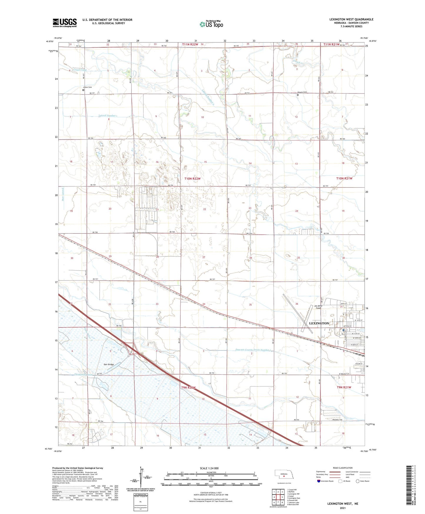
2021 topographic map quadrangle Lexington West in the state of Nebraska. Scale: 1:24000. Based on the newly updated USGS 7.5' US Topo map series, this map is in the following counties: Dawson. The map contains contour data, water features, and other items you are used to seeing on USGS maps, but also has updated roads and other features. This is the next generation of topographic maps. Printed on high-quality waterproof paper with UV fade-resistant inks.
Quads adjacent to this one:
West: Cozad
Northwest: Cozad NW
North: Buffalo
Northeast: Lexington NW
East: Lexington East
Southeast: Bertrand NW
South: Johnson Lake
Southwest: Elwood NW
Contains the following named places: Assemblies of God Conference Grounds, Bitterns Call State Wildlife Management Area, Buffalo Grove Church, Darr Bridge, Darr Feedlot, Dawson County, Dawson County Drain Number 1, First Christian Church, Grace Cemetery, Hewitt Cemetery, Jim Kelly Field, Lateral Number 1, Lexington Election Precinct, Lexington Regional Health Center, Markel, Parkview Baptist Church, Plum Creek Medical Group, Plum Creek Park, Sandoz Elementary School, School Number 16, School Number 22, School Number 38, The Church of Jesus Christ of Latter Day Saints