MyTopo
Martinsburg Nebraska US Topo Map
Couldn't load pickup availability
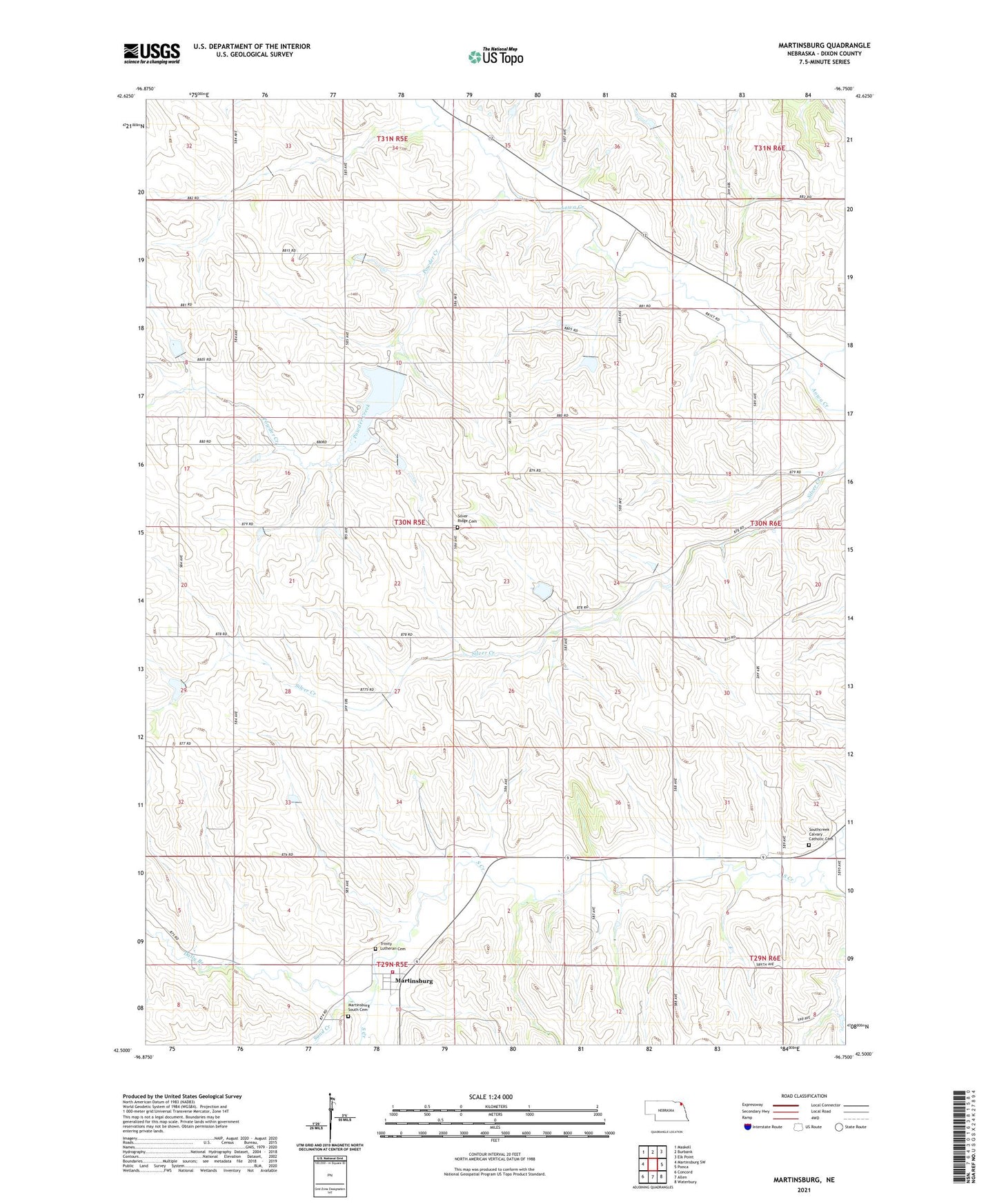
2021 topographic map quadrangle Martinsburg in the state of Nebraska. Scale: 1:24000. Based on the newly updated USGS 7.5' US Topo map series, this map is in the following counties: Dixon. The map contains contour data, water features, and other items you are used to seeing on USGS maps, but also has updated roads and other features. This is the next generation of topographic maps. Printed on high-quality waterproof paper with UV fade-resistant inks.
Quads adjacent to this one:
West: Martinsburg SW
Northwest: Maskell
North: Burbank
Northeast: Elk Point
East: Ponca
Southeast: Waterbury
South: Allen
Southwest: Concord
This map covers the same area as the classic USGS quad with code o42096e7.
Contains the following named places: Aowa Creek Dam 12-8, Aowa Creek Dam 31-1, Aowa Creek Reservoir 12-8, Aowa Creek Reservoir 31-1, Curry Dam, Daily Branch, Martinsburg, Martinsburg Post Office, Martinsburg South Cemetery, Martinsburg Volunteer Fire Department, Powder Creek, Putman School, Saint Pauls Church, Sand Creek, Silver Ridge Cemetery, Silver Ridge Post Office, South Creek School, Southcreek Calvary Catholic Cemetery, Township of Silvercreek, Trinity Lutheran Cemetery, Village of Martinsburg, West Union School, ZIP Code: 68770