MyTopo
Burbank South Dakota US Topo Map
Couldn't load pickup availability
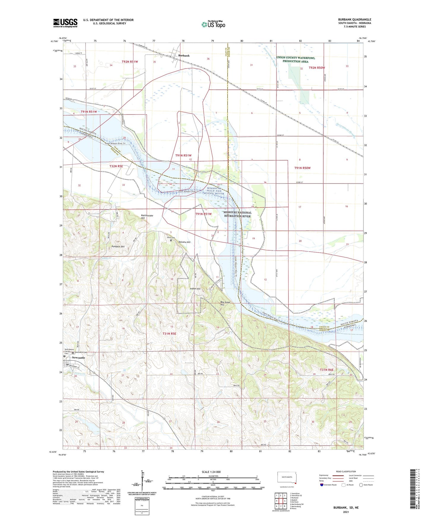
2021 topographic map quadrangle Burbank in the states of Nebraska, South Dakota. Scale: 1:24000. Based on the newly updated USGS 7.5' US Topo map series, this map is in the following counties: Union, Dixon, Clay. The map contains contour data, water features, and other items you are used to seeing on USGS maps, but also has updated roads and other features. This is the next generation of topographic maps. Printed on high-quality waterproof paper with UV fade-resistant inks.
Quads adjacent to this one:
West: Maskell
Northwest: Vermillion
North: Vermillion SE
Northeast: Richland
East: Elk Point
Southeast: Ponca
South: Martinsburg
Southwest: Martinsburg SW
This map covers the same area as the classic USGS quad with code o42096f7.
Contains the following named places: Boy Scout Hill, Burbank, Burbank Census Designated Place, Burbank Lake, Gibbs Creek, Heald Dam, Heald Reservoir, Indian Hill, Ionia, Ionia Cemetery, Ionia Post Office, Ionia 'Volcano' Historical Marker, Kate Sweeney Bend, Lembke Landing, Newcastle, Newcastle Post Office, Pfister Park, Pumpkin Hill, Rattlesnake Hill, Saint Peters Catholic Church, Township of Newcastle, Union County Waterfowl Production Area, Village of Newcastle, Volcano Hill