MyTopo
Maxwell SW Nebraska US Topo Map
Couldn't load pickup availability
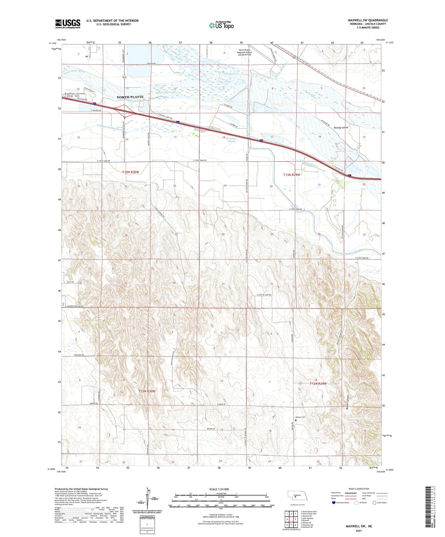
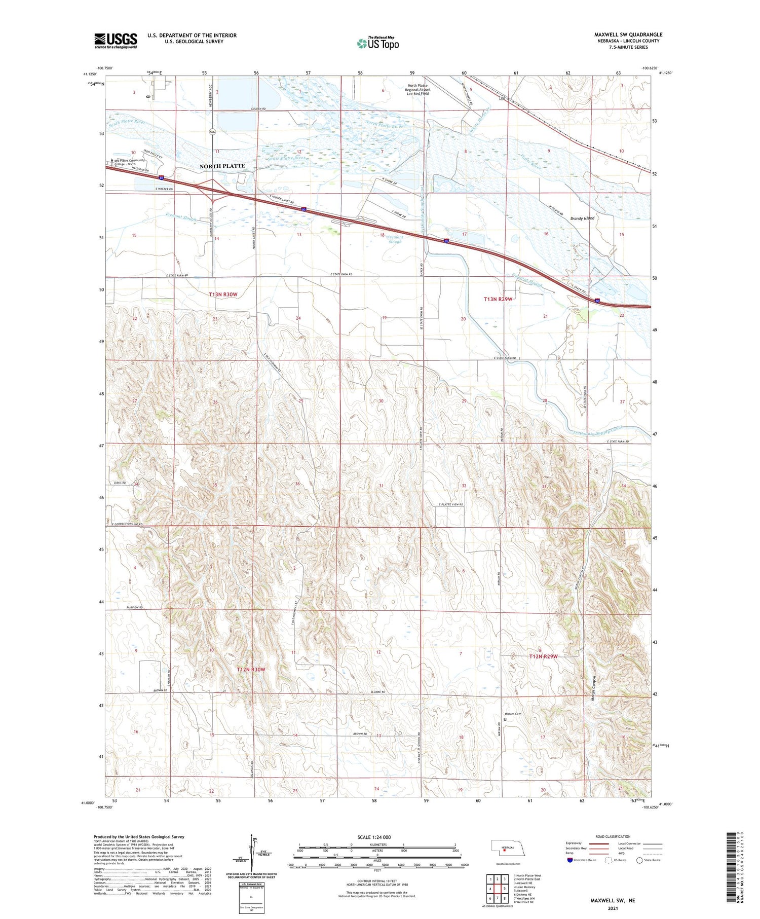
2021 topographic map quadrangle Maxwell SW in the state of Nebraska. Scale: 1:24000. Based on the newly updated USGS 7.5' US Topo map series, this map is in the following counties: Lincoln. The map contains contour data, water features, and other items you are used to seeing on USGS maps, but also has updated roads and other features. This is the next generation of topographic maps. Printed on high-quality waterproof paper with UV fade-resistant inks.
Quads adjacent to this one:
West: Lake Maloney
Northwest: North Platte West
North: North Platte East
Northeast: Maxwell NE
East: Maxwell
Southeast: Wellfleet NE
South: Wellfleet NW
Southwest: Dickens NE
Contains the following named places: Brandy Island, East Hinman Election Precinct, Fremont Slough, Fremont Slough State Wildlife Management Area, Gannett, Harden Airstrip, Iron Eagle Golf Course, Lincoln County, Mid Plains Technical College, Miriam Cemetery, Moran Canyon, North Platte Post Office, North Platte River, Platte State Wildlife Management Area, Pleasant View School, Simon Heliport, Sioux Lookout Historical Monument, Sioux Lookout School, South Platte River, Upper Diversion Dam, White Horse Creek