MyTopo
Lake Maloney Nebraska US Topo Map
Couldn't load pickup availability
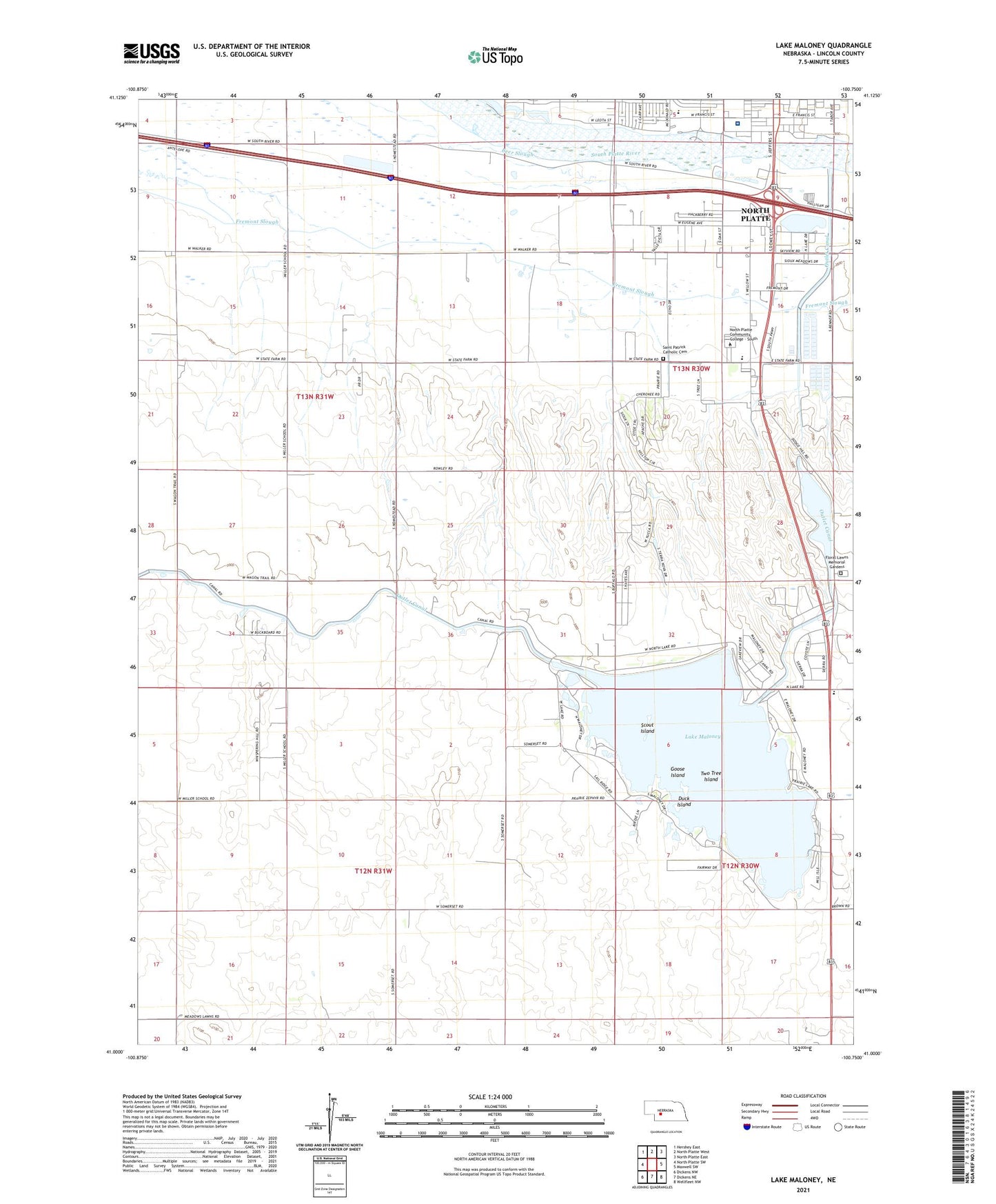
2021 topographic map quadrangle Lake Maloney in the state of Nebraska. Scale: 1:24000. Based on the newly updated USGS 7.5' US Topo map series, this map is in the following counties: Lincoln. The map contains contour data, water features, and other items you are used to seeing on USGS maps, but also has updated roads and other features. This is the next generation of topographic maps. Printed on high-quality waterproof paper with UV fade-resistant inks.
Quads adjacent to this one:
West: North Platte SW
Northwest: Hershey East
North: North Platte West
Northeast: North Platte East
East: Maxwell SW
Southeast: Wellfleet NW
South: Dickens NE
Southwest: Dickens NW
This map covers the same area as the classic USGS quad with code o41100a7.
Contains the following named places: Beer Slough, Centennial Park, Centennial Park Retirement Village, Center School, Church of Christ, D and N Event Center, Duck Island, Floral Lawns Memorial Gardens, Frontier Resort and RV Park, Goose Island, Grace Community Bible Church, Great Plains Health - Hospital, Holiday Trav-L-Park for Campers, Indian Meadows Golf Course, Interstate Park, Lake Maloney, Lake Maloney Golf Course, Lake Maloney State Recreation Area, McDonald Belton Campus Library, Mid Plains Community College, Miller Election Precinct, Miller School, Nebraska State Patrol Troop D, North Platte, North Platte Fish Hatchery, North Platte Recreation Center, Osgood Election Precinct, Osgood Elementary School, Saint Elizabeth Ann Seton Parish, Saint Patrick Catholic Cemetery, Scout Island, Seventh Day Adventist Church, The Mall, Two Tree Island, Valley Church, World Wide Church of God