MyTopo
Merna Nebraska US Topo Map
Couldn't load pickup availability
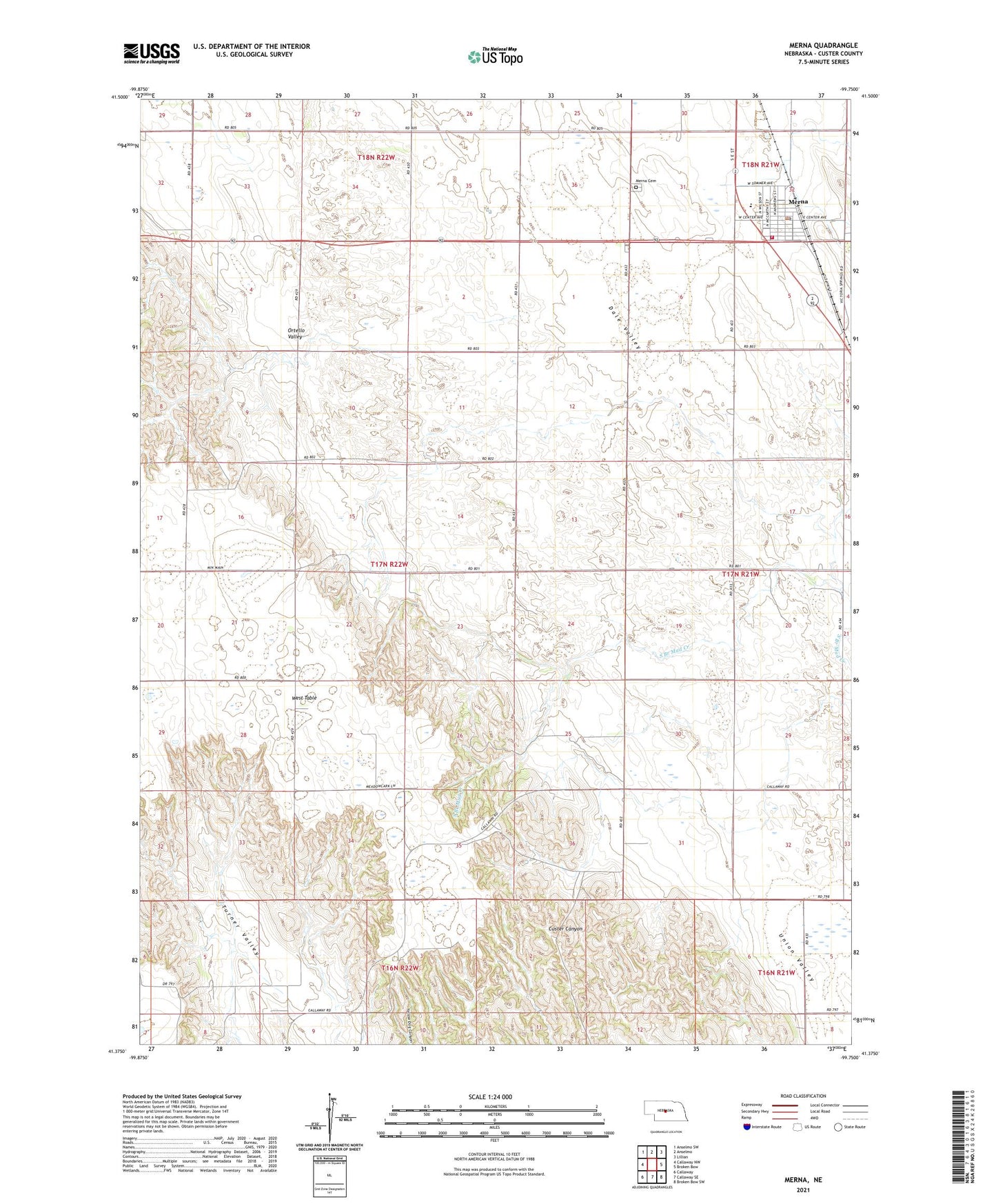
2021 topographic map quadrangle Merna in the state of Nebraska. Scale: 1:24000. Based on the newly updated USGS 7.5' US Topo map series, this map is in the following counties: Custer. The map contains contour data, water features, and other items you are used to seeing on USGS maps, but also has updated roads and other features. This is the next generation of topographic maps. Printed on high-quality waterproof paper with UV fade-resistant inks.
Quads adjacent to this one:
West: Callaway NW
Northwest: Anselmo SW
North: Anselmo
Northeast: Lillian
East: Broken Bow
Southeast: Broken Bow SW
South: Callaway SE
Southwest: Callaway
Contains the following named places: Anselmo-Merna Public Schools, Brenizer Library, Dale Valley, Immanuel Lutheran Church, Merna, Merna Cemetery, Merna Fire Rescue Department, Merna Post Office, Merna Volunteer Fire Department, Pleasant View School, Prairie Hill School, Saint Pauls Catholic Church, Sunny Knoll School, Sunshine School, Thomas School, Township of Kilfoil, Turner Valley, Turner Valley School, Union Valley, United Methodist Church, Village of Merna