MyTopo
Merriman Nebraska US Topo Map
Couldn't load pickup availability
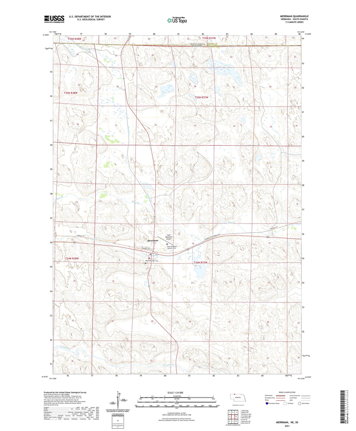
2021 topographic map quadrangle Merriman in the state of Nebraska. Scale: 1:24000. Based on the newly updated USGS 7.5' US Topo map series, this map is in the following counties: Cherry, Bennett. The map contains contour data, water features, and other items you are used to seeing on USGS maps, but also has updated roads and other features. This is the next generation of topographic maps. Printed on high-quality waterproof paper with UV fade-resistant inks.
Quads adjacent to this one:
West: Trumbull Lake
Northwest: Allan Dam
North: Martin SW
Northeast: Phantom Lake
East: Merriman NE
Southeast: Merriman SE
South: Merriman SW
Southwest: Irwin SE
Contains the following named places: Arthur Bowring Sandhill Ranch, Arthur Bowring Sandhills Ranch State Historical Park, Bates Ranch, Boltz Ranch, Cole Memorial Airport, Cooperative Non-Stock Grain Association Elevator, Cottonwood Lake, Cottonwood Lake Camping Area, Cottonwood Lake State Recreation Area, Dry Creek, Eve Bowring Visitor Center, Gardner Ranch, Garould Fairhead Ranch, Gray Ranch, Heckel Creek, Jay Fairhead Ranch, McConaughey Ranch, Merriman, Merriman Post Office, Merriman Public School, Merriman Volunteer Fire Department, Moreland Ranch, Sandhills Rescue - Ambulance Service, Sandoz Ranch, Shady Spot RV Camp, Village of Merriman, Weber Ranch