MyTopo
Mitchell Nebraska US Topo Map
Couldn't load pickup availability
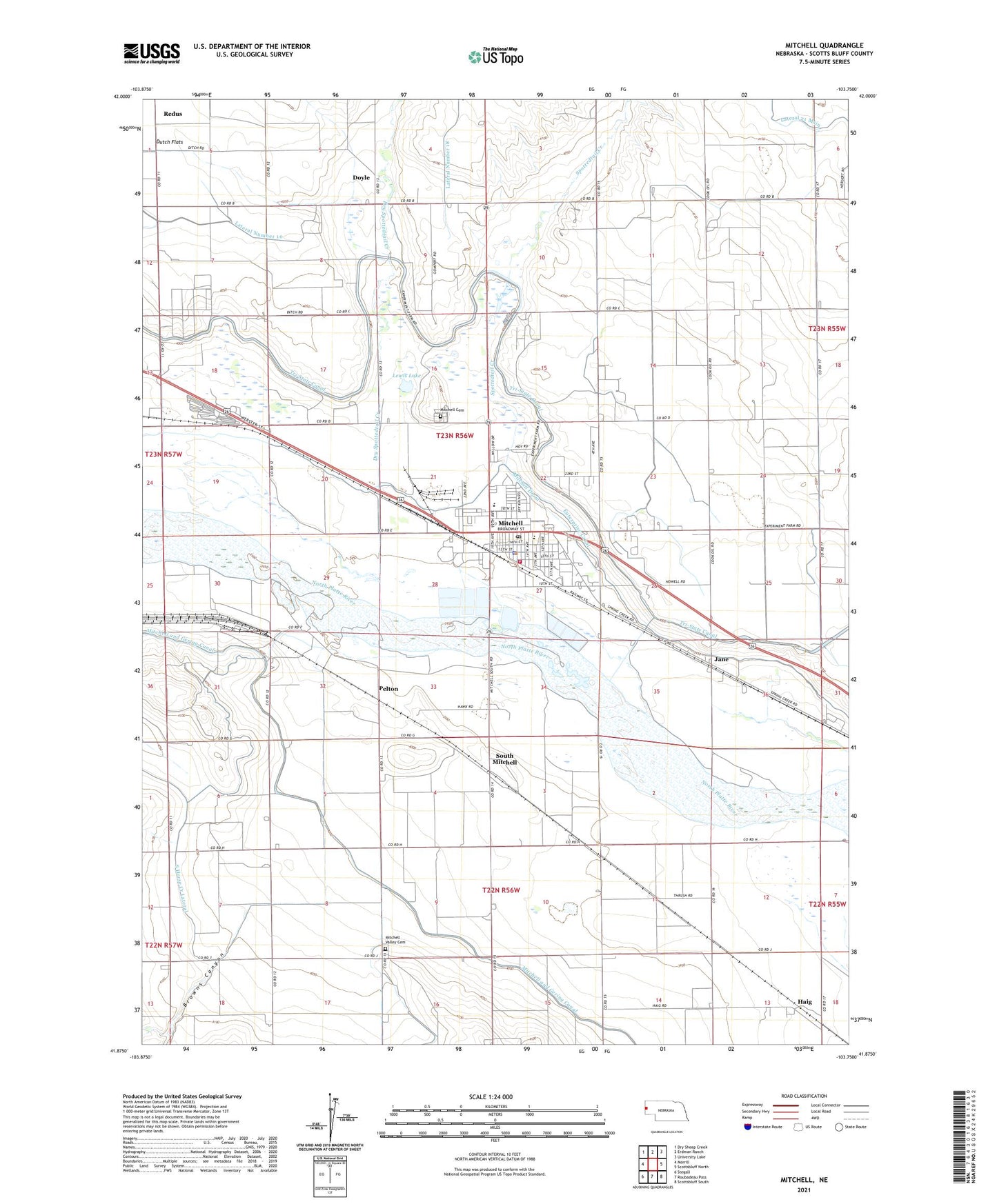
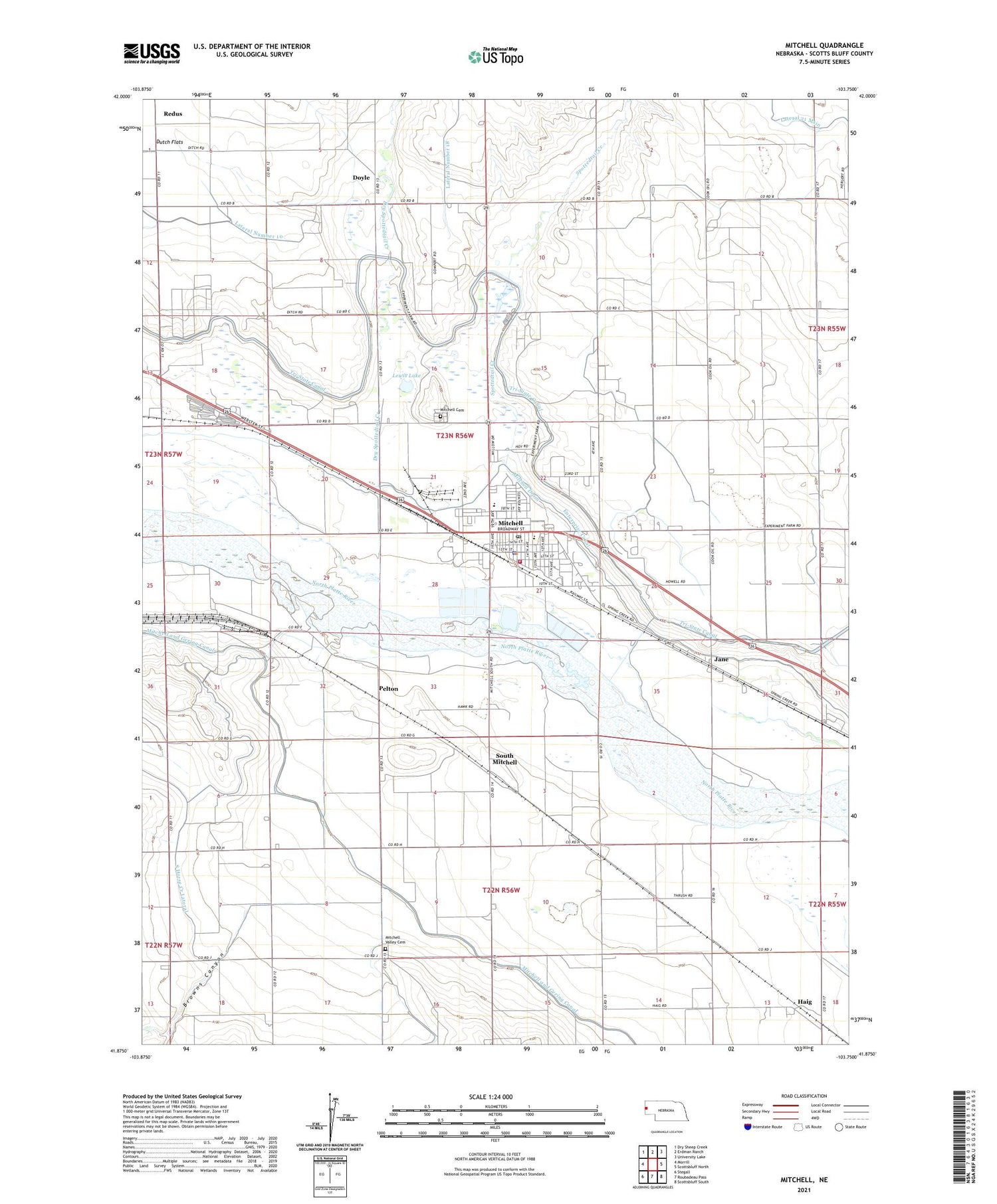
2021 topographic map quadrangle Mitchell in the state of Nebraska. Scale: 1:24000. Based on the newly updated USGS 7.5' US Topo map series, this map is in the following counties: Scotts Bluff. The map contains contour data, water features, and other items you are used to seeing on USGS maps, but also has updated roads and other features. This is the next generation of topographic maps. Printed on high-quality waterproof paper with UV fade-resistant inks.
Quads adjacent to this one:
West: Morrill
Northwest: Dry Sheep Creek
North: Erdman Ranch
Northeast: University Lake
East: Scottsbluff North
Southeast: Scottsbluff South
South: Roubadeau Pass
Southwest: Stegall
Contains the following named places: Assembly of God Church, Berean Fundamental Church, Browns Canyon, City of Mitchell, Doyle, Dry Spottedtail Creek, Fairview School, Fanning Election Precinct, Federated Churches, Haig, Haig Post Office, Holy Apostles Episcopal Church, Jane, Kelley Bean Company Incorporated Elevator, Koinonia Fellowship Church, Lateral 21 Main, Lewis Lake, Mitchell, Mitchell Berean Church, Mitchell Care Center, Mitchell Cemetery, Mitchell Drain, Mitchell Elementary School, Mitchell Evangelical Church, Mitchell Medical Center, Mitchell Police Department, Mitchell Post Office, Mitchell Public Library, Mitchell Secondary School, Mitchell Valley Cemetery, Mitchell Valley School, Mitchell Volunteer Fire Department, Pelton, Redus, S East Bald Peak Drain, Saint Pauls United Church, Saint Theresa Catholic Church, Scenic Knolls Golf Course, Scotts Bluff County Fairgrounds, South Mitchell, Spottedtail Creek, Sunflower Mobile Home Park, Sunnyslope School, United Methodist Church