MyTopo
University Lake Nebraska US Topo Map
Couldn't load pickup availability
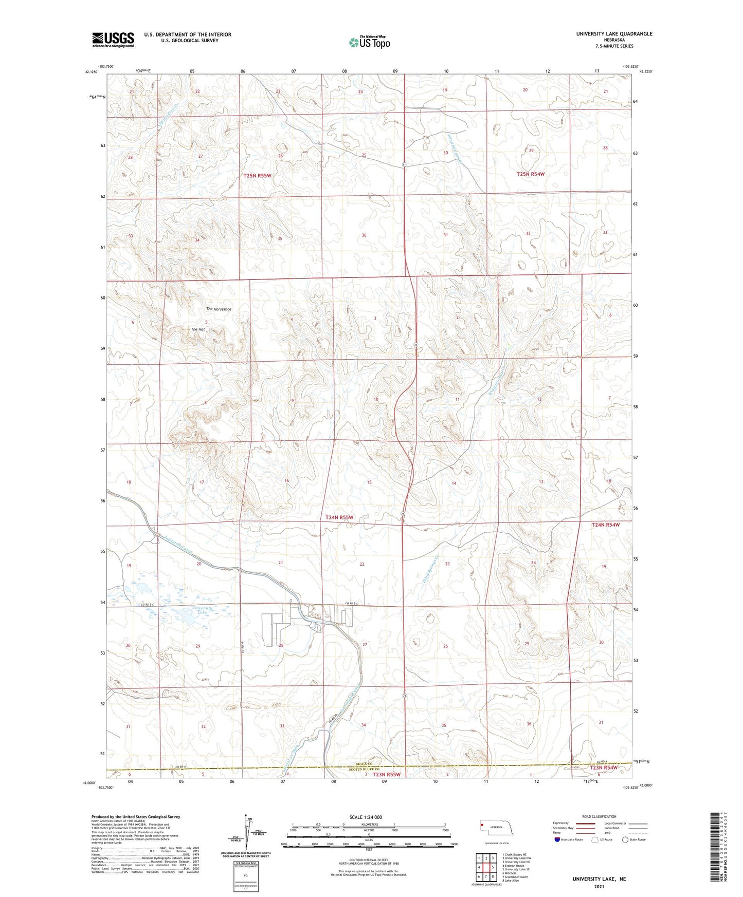
2021 topographic map quadrangle University Lake in the state of Nebraska. Scale: 1:24000. Based on the newly updated USGS 7.5' US Topo map series, this map is in the following counties: Sioux, Scotts Bluff. The map contains contour data, water features, and other items you are used to seeing on USGS maps, but also has updated roads and other features. This is the next generation of topographic maps. Printed on high-quality waterproof paper with UV fade-resistant inks.
Quads adjacent to this one:
West: Erdman Ranch
Northwest: Chalk Buttes NE
North: University Lake NW
Northeast: University Lake NE
East: University Lake SE
Southeast: Lake Alice
South: Scottsbluff North
Southwest: Mitchell
This map covers the same area as the classic USGS quad with code o42103a6.
Contains the following named places: Claypit Well, F-X Ranch, High Plains Feed Yard, Logan Well, Number 15 Well, Number 4 Well, Point Option Ranch, Samson Well, South Camp, The Hat, The Horseshoe, University Lake, Wind Springs Creek, Wind Springs Ranch