MyTopo
Morrill Nebraska US Topo Map
Couldn't load pickup availability
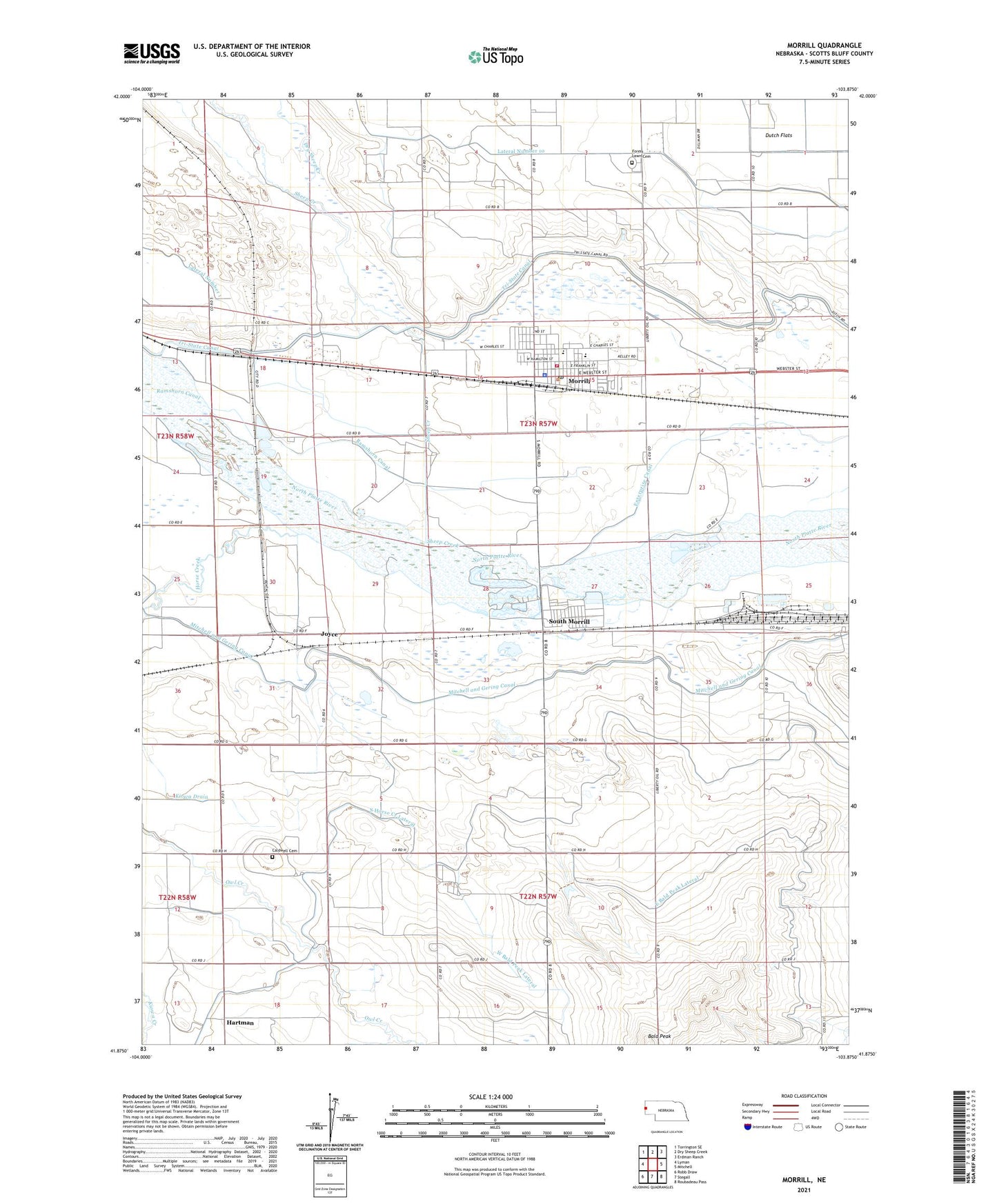
2021 topographic map quadrangle Morrill in the state of Nebraska. Scale: 1:24000. Based on the newly updated USGS 7.5' US Topo map series, this map is in the following counties: Scotts Bluff. The map contains contour data, water features, and other items you are used to seeing on USGS maps, but also has updated roads and other features. This is the next generation of topographic maps. Printed on high-quality waterproof paper with UV fade-resistant inks.
Quads adjacent to this one:
West: Lyman
Northwest: Torrington SE
North: Dry Sheep Creek
Northeast: Erdman Ranch
East: Mitchell
Southeast: Roubadeau Pass
South: Stegall
Southwest: Robb Draw
This map covers the same area as the classic USGS quad with code o41103h8.
Contains the following named places: Bald Peak, Bald Peak Group Detention Dam, Caldwell, Caldwell Cemetery, Caldwell Post Office, Church of Christ, Dry Sheep Creek, East Bald Peak Lateral, Enterprise, Ford Election Precinct, Forest Lawn Cemetery, Hartman, Horse Creek, Independent Baptist Church, Joyce, Kelley Bean Company Incorporated Elevator, Kiowa Drain, Kiowa State Wildlife Management Area, Lateral 10 Main, Lippencott Reservoir, Methodist Church, Morrill, Morrill Elementary School, Morrill Fire Department, Morrill High School, Morrill Mobile Home Estates, Morrill Police Department, Morrill Post Office, Morrill Public Library, Presbyterian Church, Ramshorn Canal, Rolling Green Country Club, Russell School, Saint Ann Catholic Church, Sheep Creek, South Horse Creek Lateral, South Morrill, Trinity Lutheran Church, Village of Morrill, West Bald Peak Lateral