MyTopo
Monterey Nebraska US Topo Map
Couldn't load pickup availability
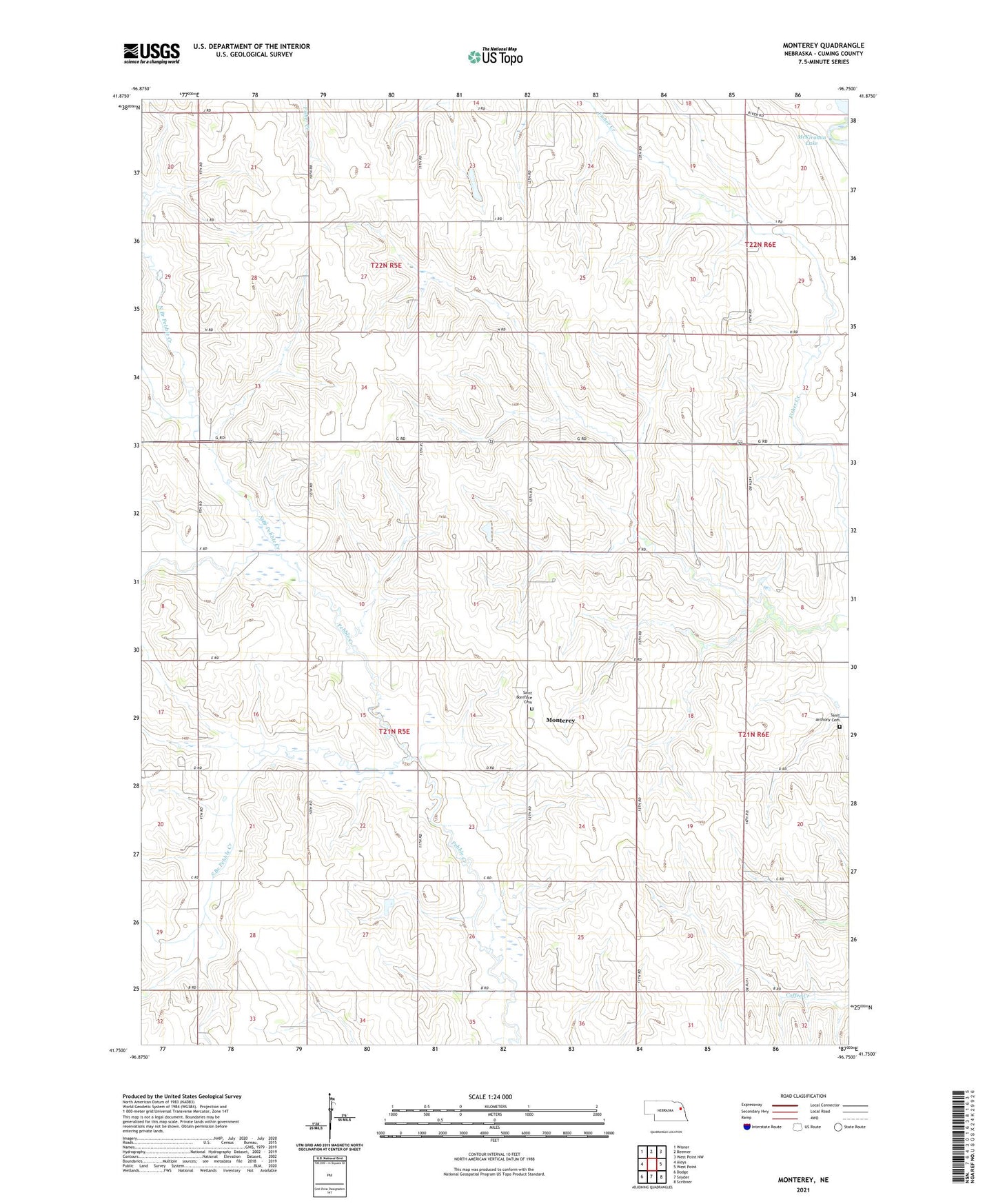
2021 topographic map quadrangle Monterey in the state of Nebraska. Scale: 1:24000. Based on the newly updated USGS 7.5' US Topo map series, this map is in the following counties: Cuming. The map contains contour data, water features, and other items you are used to seeing on USGS maps, but also has updated roads and other features. This is the next generation of topographic maps. Printed on high-quality waterproof paper with UV fade-resistant inks.
Quads adjacent to this one:
West: Aloys
Northwest: Wisner
North: Beemer
Northeast: West Point NW
East: West Point
Southeast: Scribner
South: Snyder
Southwest: Dodge
Contains the following named places: McKirahan Lake, Monterey, Monterey Post Office, North Branch Pebble Creek, Saint Anthony Cemetery, Saint Anthonys Church, Saint Boniface Cemetery, Saint Boniface Church, School Number 41, South Branch Pebble Creek, Township of Elkhorn, Township of Monterey, Township of Saint Charles