MyTopo
Dodge Nebraska US Topo Map
Couldn't load pickup availability
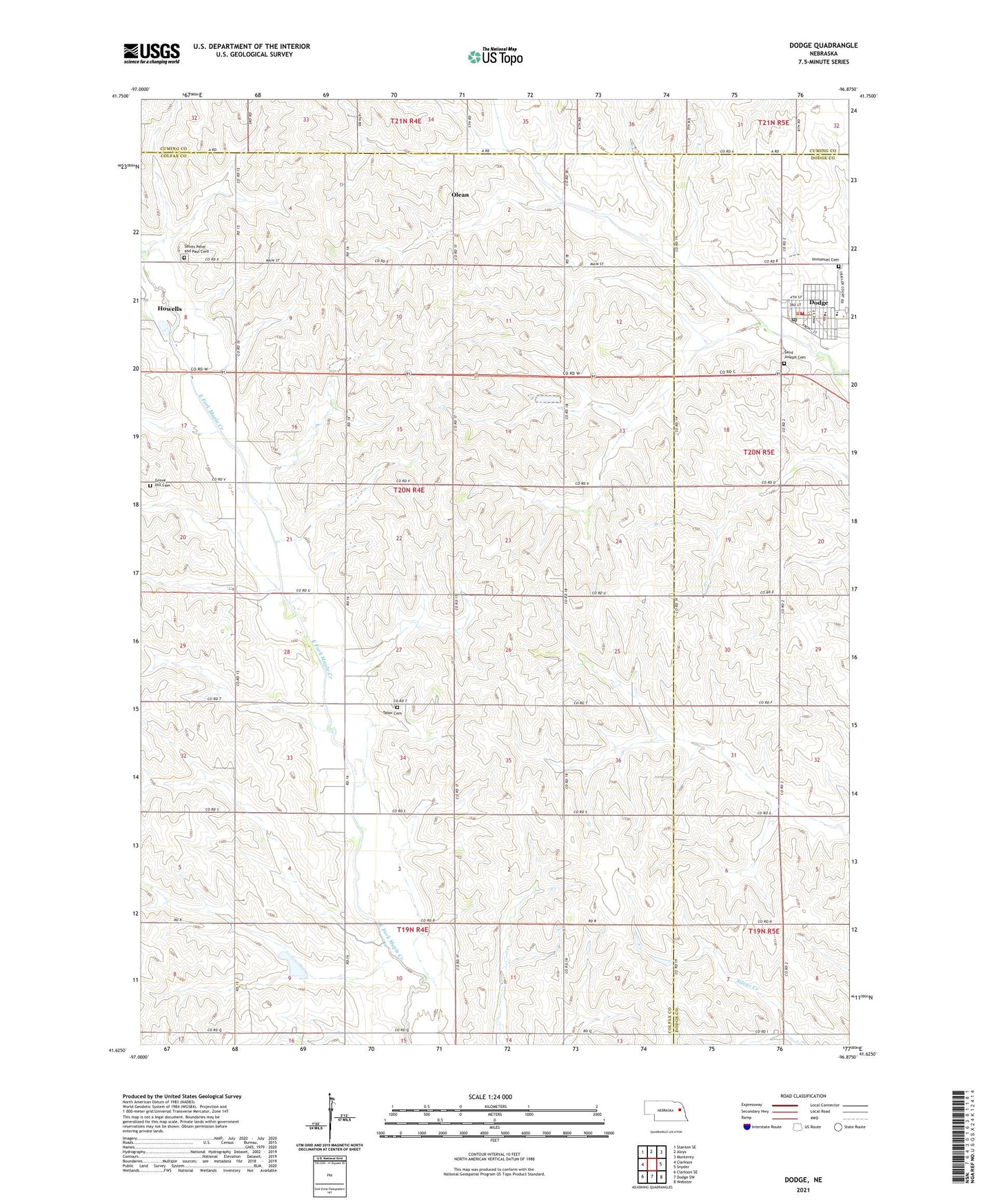
2021 topographic map quadrangle Dodge in the state of Nebraska. Scale: 1:24000. Based on the newly updated USGS 7.5' US Topo map series, this map is in the following counties: Colfax, Dodge, Cuming. The map contains contour data, water features, and other items you are used to seeing on USGS maps, but also has updated roads and other features. This is the next generation of topographic maps. Printed on high-quality waterproof paper with UV fade-resistant inks.
Quads adjacent to this one:
West: Clarkson
Northwest: Stanton SE
North: Aloys
Northeast: Monterey
East: Snyder
Southeast: Webster
South: Dodge SW
Southwest: Clarkson SE
This map covers the same area as the classic USGS quad with code o41096f8.
Contains the following named places: Dodge, Dodge Dental Office, Dodge Library, Dodge Medical Clinic, Dodge Police Station, Dodge Post Office, Dodge Public Schools, Dodge Rescue Unit, Dodge Volunteer Fire Department, Dostal-Bradley Airport, Grove Hill Cemetery, Holsten Park, Immanuel Cemetery, Immanuel Lutheran Church, Lincoln Election Precinct, Olean, Olean Post Office, Parkview Home Incorporated, Sacred Heart Church, Sacred Heart School, Saint Joseph Cemetery, Saint Marys Church, Saint Wenceslaus Church, Saint Wenceslaus Elementary School, Saints Peter and Paul Cemetery, School Number 32, Tabor Cemetery, Township of Lincoln, Village of Dodge, ZIP Code: 68633