MyTopo
West Point Nebraska US Topo Map
Couldn't load pickup availability
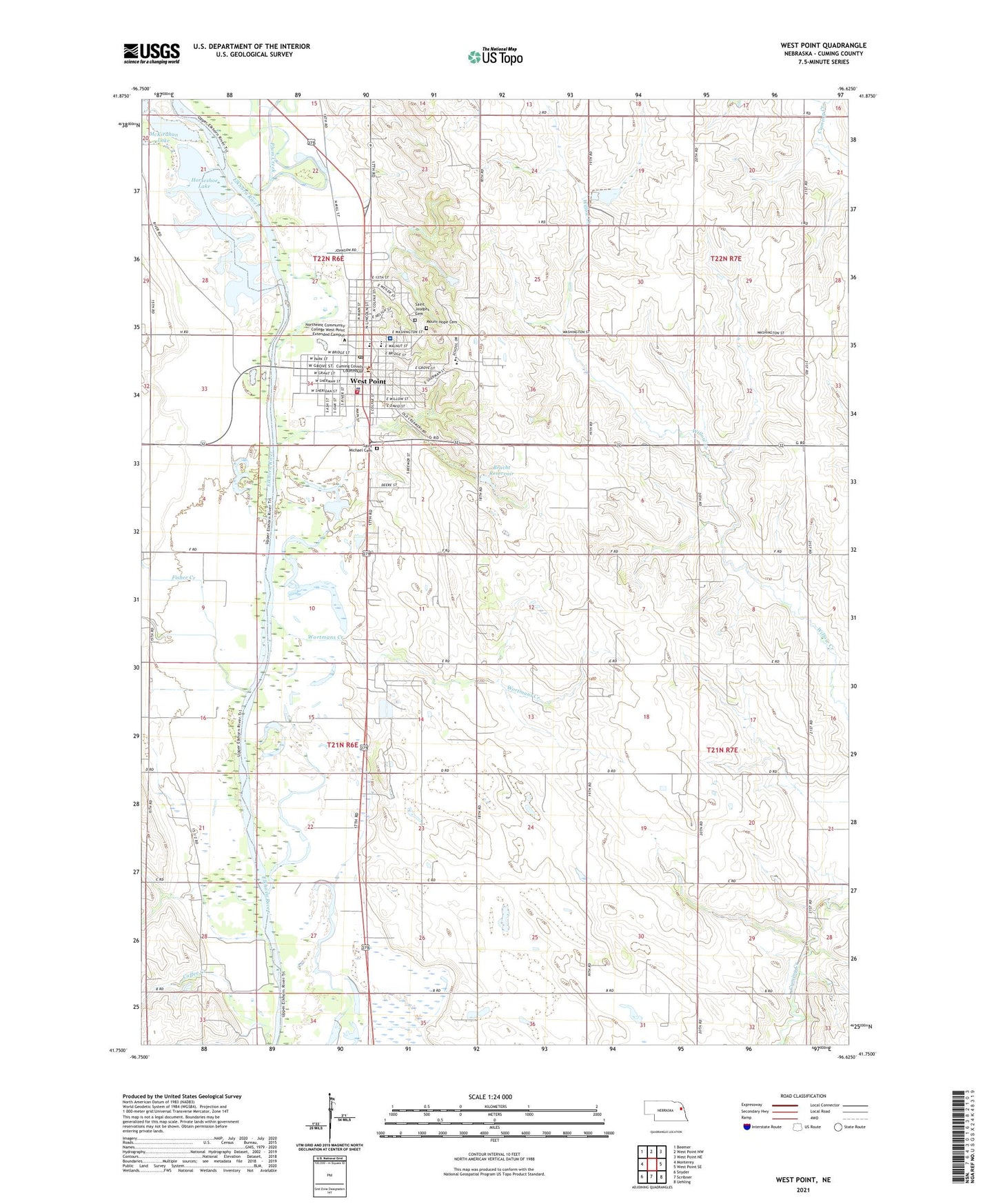
2021 topographic map quadrangle West Point in the state of Nebraska. Scale: 1:24000. Based on the newly updated USGS 7.5' US Topo map series, this map is in the following counties: Cuming. The map contains contour data, water features, and other items you are used to seeing on USGS maps, but also has updated roads and other features. This is the next generation of topographic maps. Printed on high-quality waterproof paper with UV fade-resistant inks.
Quads adjacent to this one:
West: Monterey
Northwest: Beemer
North: West Point NW
Northeast: West Point NE
East: West Point SE
Southeast: Uehling
South: Scribner
Southwest: Snyder
This map covers the same area as the classic USGS quad with code o41096g6.
Contains the following named places: Bracht Feedyards, Bracht Floodwater Retarding Dam, Bracht Reservoir, Central Catholic High School, Church of Christ, City of West Point, Coffee Creek, Cuming County Courthouse, Cuming County Fairgrounds, Cuming County Historical Society Museum Complex, Cuming County Sheriff's Office, Dinklage Medical Clinic, Elkhorn Valley Assembly of God Church, Elkhorn Valley Clinic, Family Vision Center, Fisher Creek, Grace Lutheran Church, Guardian Angel Elementary School, Horseshoe Lake, Jehovahs Witnesses Kingdom Hall, John A Stahl Library, Knievel Airport, KWPN-AM (West Point), KWPN-FM (West Point), Midwest Ear Nose and Throat Clinic, Mount Hope Cemetery, Neligh Park, Neligh Park Campground, Plum Creek, Prinz Grain and Feed Incorporated Elevator, Saint Aloysius Church, Saint Charles, Saint Charles Post Office, Saint Francis Memorial Hospital, Saint Josephs Cemetery, Saint Mary Catholic Church, Saint Marys Convent, Saint Michael Cemetery, Saint Pauls Lutheran Church, Saint Pauls Lutheran Elementary School, School Number 10, Stover Chiropractic Clinic, Township of Sherman, Trinity Interdenominational Church, West Point, West Point Baptist Church, West Point City Park, West Point Elementary School, West Point Fire Department and Rescue Squad, West Point High School, West Point Living Center, West Point Police Department, West Point Post Office, Wilderness Park, Wortmans Creek, ZIP Code: 68788