MyTopo
Aloys Nebraska US Topo Map
Couldn't load pickup availability
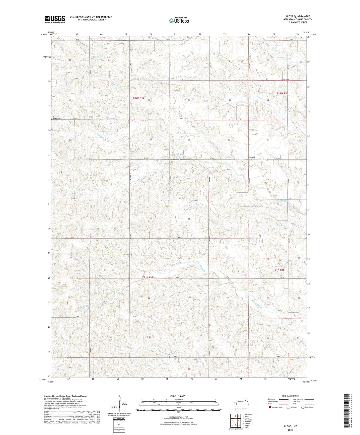
2021 topographic map quadrangle Aloys in the state of Nebraska. Scale: 1:24000. Based on the newly updated USGS 7.5' US Topo map series, this map is in the following counties: Cuming. The map contains contour data, water features, and other items you are used to seeing on USGS maps, but also has updated roads and other features. This is the next generation of topographic maps. Printed on high-quality waterproof paper with UV fade-resistant inks.
Quads adjacent to this one:
West: Stanton SE
Northwest: Stanton NE
North: Wisner
Northeast: Beemer
East: Monterey
Southeast: Snyder
South: Dodge
Southwest: Clarkson
This map covers the same area as the classic USGS quad with code o41096g8.
Contains the following named places: Aloys, Aloys Post Office, Coufal Feedyards, Saint Peters Cemetery, School Number 75, Township of Bismark, Township of Lincoln, Zion School