MyTopo
Mount Clare Nebraska US Topo Map
Couldn't load pickup availability
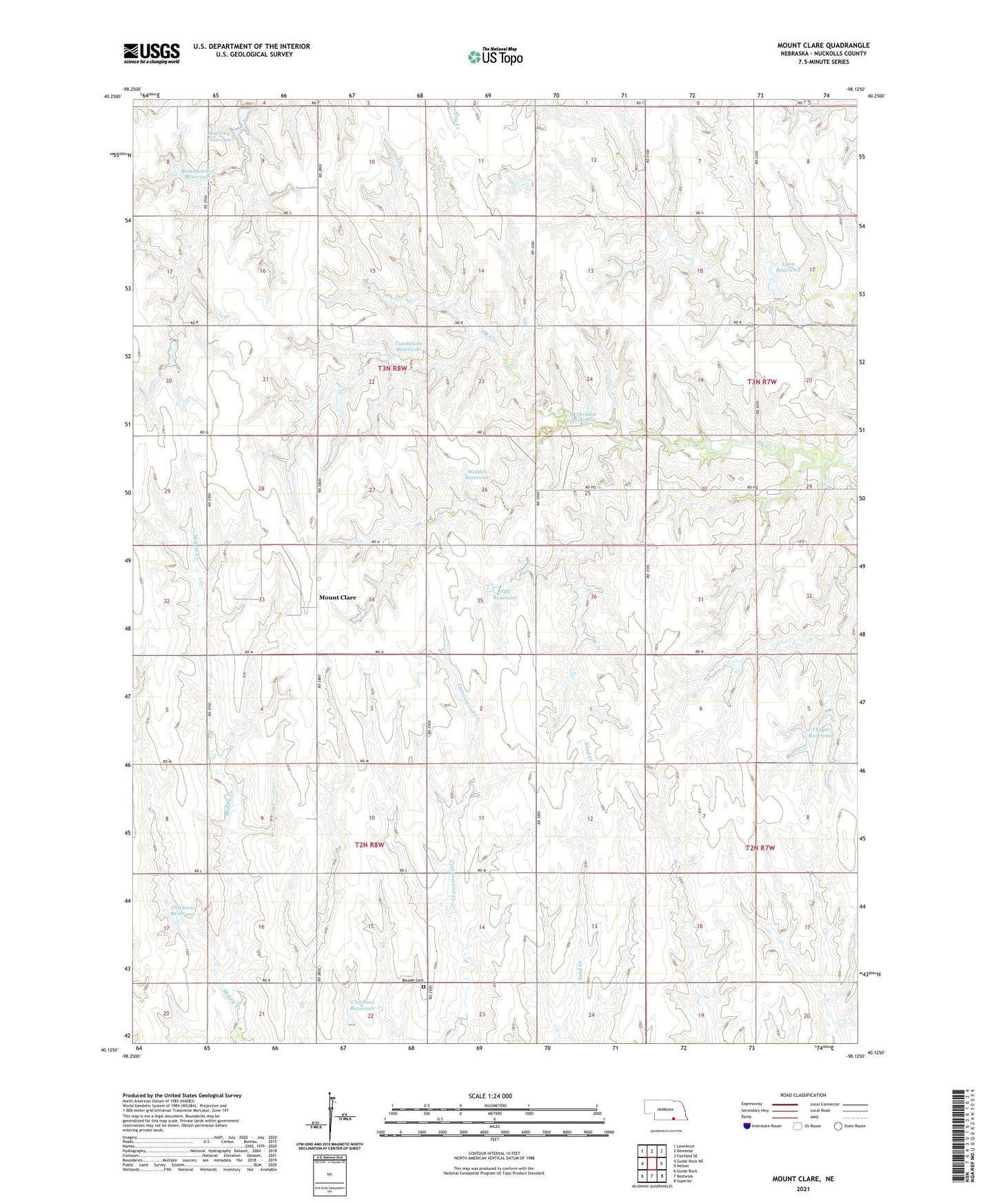
2021 topographic map quadrangle Mount Clare in the state of Nebraska. Scale: 1:24000. Based on the newly updated USGS 7.5' US Topo map series, this map is in the following counties: Nuckolls. The map contains contour data, water features, and other items you are used to seeing on USGS maps, but also has updated roads and other features. This is the next generation of topographic maps. Printed on high-quality waterproof paper with UV fade-resistant inks.
Quads adjacent to this one:
West: Guide Rock NE
Northwest: Lawrence
North: Deweese
Northeast: Fairfield SE
East: Nelson
Southeast: Superior
South: Bostwick
Southwest: Guide Rock
Contains the following named places: Alban Election Precinct, Beulah Cemetery, Buschkoetter Dam, Buschkoetter Reservoir, Childress Dam, Childress Reservoir, Hoelting Dam, Hoelting Reservoir, Lyon Dam, Lyon Reservoir, Mount Clare, Mount Clare Post Office, NBC Dam, NBC Reservoir, Saint Stephens Election Precinct, Thayer Dam, Thayer Reservoir, Tumbelson Dam, Tumbelson Reservoir, Victor Election Precinct, Walden Dam, Walden Reservoir, Wehrman Dam-1 Dam, Wehrman Reservoir