MyTopo
Lawrence Nebraska US Topo Map
Couldn't load pickup availability
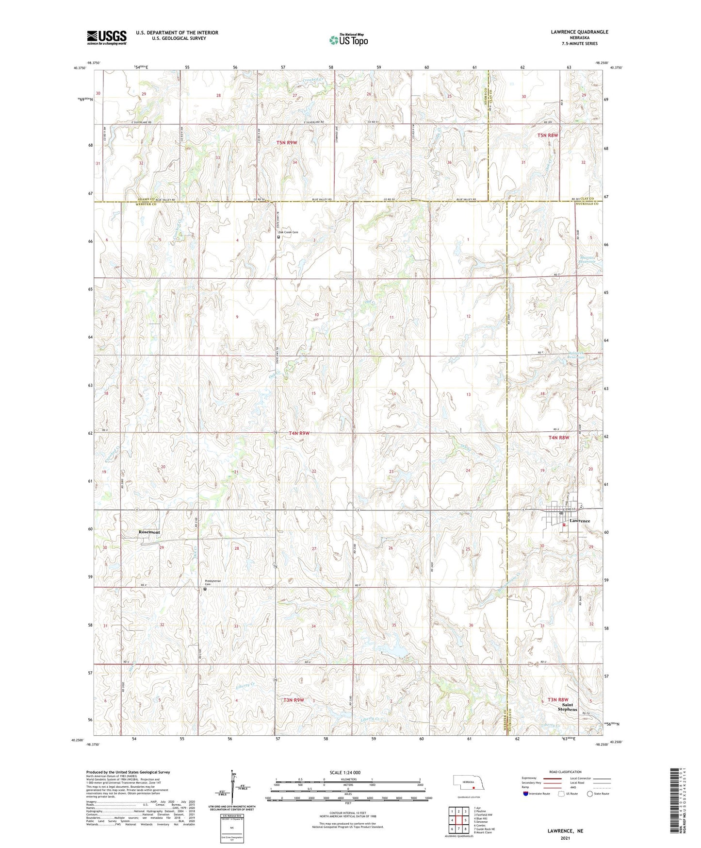
2021 topographic map quadrangle Lawrence in the state of Nebraska. Scale: 1:24000. Based on the newly updated USGS 7.5' US Topo map series, this map is in the following counties: Webster, Adams, Nuckolls, Clay. The map contains contour data, water features, and other items you are used to seeing on USGS maps, but also has updated roads and other features. This is the next generation of topographic maps. Printed on high-quality waterproof paper with UV fade-resistant inks.
Quads adjacent to this one:
West: Blue Hill
Northwest: Ayr
North: Pauline
Northeast: Fairfield NW
East: Deweese
Southeast: Mount Clare
South: Guide Rock NE
Southwest: Cowles
This map covers the same area as the classic USGS quad with code o40098c3.
Contains the following named places: Dolnicek Dam, Dolnicek Reservoir, Lawrence, Lawrence Country Club, Lawrence Post Office, Lawrence Volunteer Fire Department, Lawrence-Nelson Elementary School, Liberty Cove Recreation Area, Mazour Reservoir, Oak Creek Cemetery, Presbyterian Cemetery, Rosemont, Rosemont Post Office, Sacred Heart Catholic Church, Sacred Heart Elementary School, Saint Stephens, Saint Stephens Catholic Church, Saint Stephens Post Office, Township of Oak Creek, Township of Stillwater, Village of Lawrence