MyTopo
Tilden NE Nebraska US Topo Map
Couldn't load pickup availability
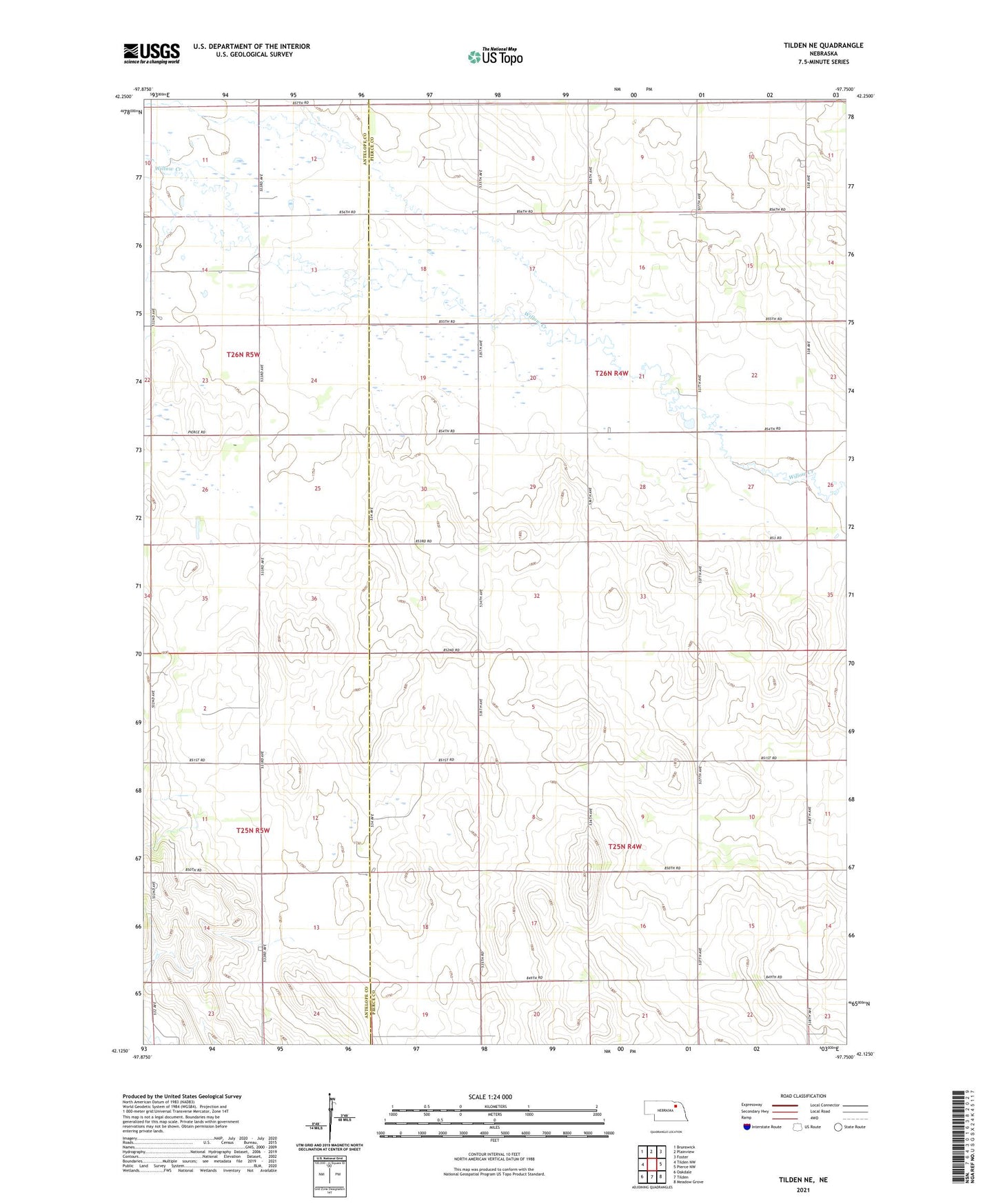
2021 topographic map quadrangle Tilden NE in the state of Nebraska. Scale: 1:24000. Based on the newly updated USGS 7.5' US Topo map series, this map is in the following counties: Pierce, Antelope. The map contains contour data, water features, and other items you are used to seeing on USGS maps, but also has updated roads and other features. This is the next generation of topographic maps. Printed on high-quality waterproof paper with UV fade-resistant inks.
Quads adjacent to this one:
West: Tilden NW
Northwest: Brunswick
North: Plainview
Northeast: Foster
East: Pierce NW
Southeast: Meadow Grove
South: Tilden
Southwest: Oakdale
This map covers the same area as the classic USGS quad with code o42097b7.
Contains the following named places: Al Hopkins Creek, Hunt School, Lake Valley School, Mills Election Precinct, Prairie General School, Rowell Lake, Stark Valley Church, Township of Mills, Township of Willow Creek, Willow Creek Election Precinct