MyTopo
Odell NE Nebraska US Topo Map
Couldn't load pickup availability
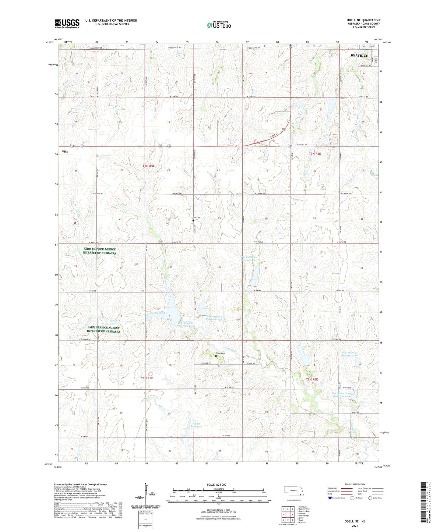
2021 topographic map quadrangle Odell NE in the state of Nebraska. Scale: 1:24000. Based on the newly updated USGS 7.5' US Topo map series, this map is in the following counties: Gage. The map contains contour data, water features, and other items you are used to seeing on USGS maps, but also has updated roads and other features. This is the next generation of topographic maps. Printed on high-quality waterproof paper with UV fade-resistant inks.
Quads adjacent to this one:
West: Harbine
Northwest: Plymouth
North: Beatrice West
Northeast: Beatrice East
East: Blue Springs
Southeast: Wymore
South: Odell
Southwest: Diller
Contains the following named places: Anyon Cemetery, Big Indian Creek Dam 12-1, Big Indian Creek Dam 12-A, Big Indian Creek Dam 13-B, Big Indian Creek Dam 13-C, Big Indian Creek Dam 14-A, Big Indian Creek Dam 14-B, Big Indian Creek Reservoir 12-1, Big Indian Creek Reservoir 13-B, Big Indian Creek Reservoir 13-C, Big Indian Creek Reservoir 14-A, Big Indian Creek Reservoir 14-B, Big Indian Greek Reservoir 12-A, Ellis Cemetery, Hidden Acres Country Club, Hidden Acres Golf Club, Linsenmeyer Farms, Snyder Dam, Snyder Reservoir, Township of Elm, Township of Lincoln