MyTopo
Blue Springs Nebraska US Topo Map
Couldn't load pickup availability
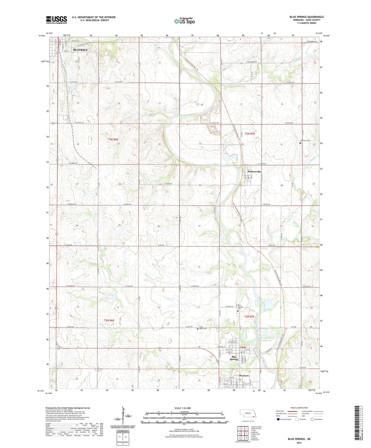
2021 topographic map quadrangle Blue Springs in the state of Nebraska. Scale: 1:24000. Based on the newly updated USGS 7.5' US Topo map series, this map is in the following counties: Gage. The map contains contour data, water features, and other items you are used to seeing on USGS maps, but also has updated roads and other features. This is the next generation of topographic maps. Printed on high-quality waterproof paper with UV fade-resistant inks.
Quads adjacent to this one:
West: Odell NE
Northwest: Beatrice West
North: Beatrice East
Northeast: Filley
East: Wymore NE
Southeast: Barneston
South: Wymore
Southwest: Odell
This map covers the same area as the classic USGS quad with code o40096b6.
Contains the following named places: Arbor Park, Bear Creek, Beatrice Country Club, Bills Creek, Bloody Run, Blue Springs, Blue Springs Cemetery, Blue Springs Post Office, Blue Springs Power Plant Dam, Blue Springs Power Plant Reservoir, Blue Springs Volunteer Fire Department, Brethren Cemetery, Brethren Church, Bridge School, Cedar Creek, Church of Christ, Church of the Promise, City of Blue Springs, Farmers Union Co-operative Elevator, Feit Memorial Park, Feit Memorial Park Campground, Holmesville, Holmesville Census Designated Place, Holmesville Post Office, Holmesville Power Plant Dam, Holmesville Power Plant Reservoir, Holmesville School, Maple Grove School, Mud Creek, Our Saviours Lutheran Church, Pleasant Prairie School, Putnam, Putnam Post Office, Riverside School, Saint Marys Cemetery, Searcey Grain Company Elevator, Sicily, Sicily Post Office, Southern Elementary School, Township of Blue Springs-Wymore, Township of Riverside, Township of Rockford, Township of Sicily, United Presbyterian Church, ZIP Codes: 68310, 68318