MyTopo
Ong Nebraska US Topo Map
Couldn't load pickup availability
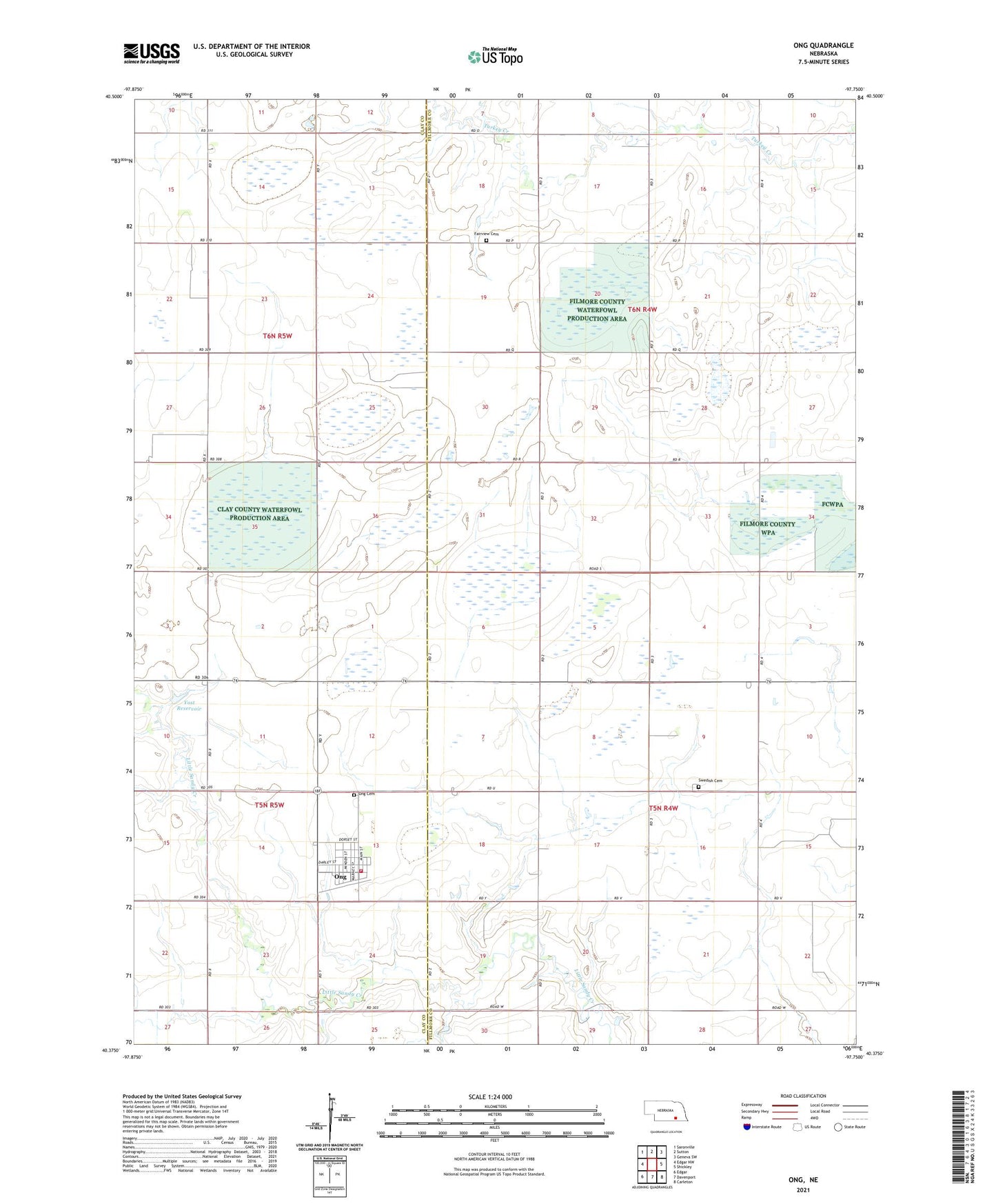
2021 topographic map quadrangle Ong in the state of Nebraska. Scale: 1:24000. Based on the newly updated USGS 7.5' US Topo map series, this map is in the following counties: Fillmore, Clay. The map contains contour data, water features, and other items you are used to seeing on USGS maps, but also has updated roads and other features. This is the next generation of topographic maps. Printed on high-quality waterproof paper with UV fade-resistant inks.
Quads adjacent to this one:
West: Edgar NW
Northwest: Saronville
North: Sutton
Northeast: Geneva SW
East: Shickley
Southeast: Carleton
South: Davenport
Southwest: Edgar
Contains the following named places: Aurora Cooperative Elevator Company Elevator, Fairview Cemetery, Green Wing State Wildlife Management Area, Hansen Lagoon Natl Wildlife Mgt Area, Krause Lagoon Natl Wildlife Mgt Area, Little Sandy Creek, Mallard Haven Natl Wildlife Mgt Area, Ong, Ong Cemetery, Ong Post Office, Ong Rural Fire Protection District, Stockholm Church, Stockholm Lutheran Church and Swedish Cemetery Historical Marker, Swedish Cemetery, Township of Bryant, Township of Momence, Village of Ong, Yost Dam, Yost Reservoir, ZIP Code: 68452