MyTopo
Pleasanton NW Nebraska US Topo Map
Couldn't load pickup availability
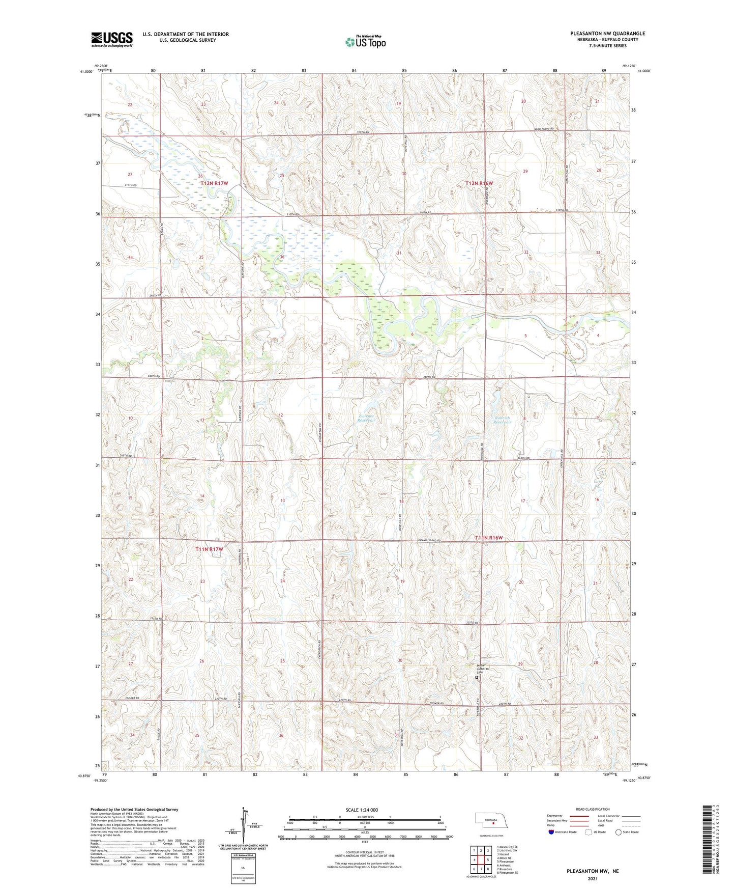
2021 topographic map quadrangle Pleasanton NW in the state of Nebraska. Scale: 1:24000. Based on the newly updated USGS 7.5' US Topo map series, this map is in the following counties: Buffalo. The map contains contour data, water features, and other items you are used to seeing on USGS maps, but also has updated roads and other features. This is the next generation of topographic maps. Printed on high-quality waterproof paper with UV fade-resistant inks.
Quads adjacent to this one:
West: Miller NE
Northwest: Mason City SE
North: Litchfield SW
Northeast: Hazard
East: Pleasanton
Southeast: Pleasanton SE
South: Riverdale
Southwest: Amherst
Contains the following named places: Death Creek, Deer Creek, Peake Lutheran Cemetery, Rohrich Dam, Rohrich Reservoir, Sartoria, Sartoria Post Office, School Number 45, School Number 73, School Number 80, Swenson Creek, Township of Rusco, Zweiner Dam, Zwiener Dam-1 Dam, Zwiener Reservoir