MyTopo
Polk Nebraska US Topo Map
Couldn't load pickup availability
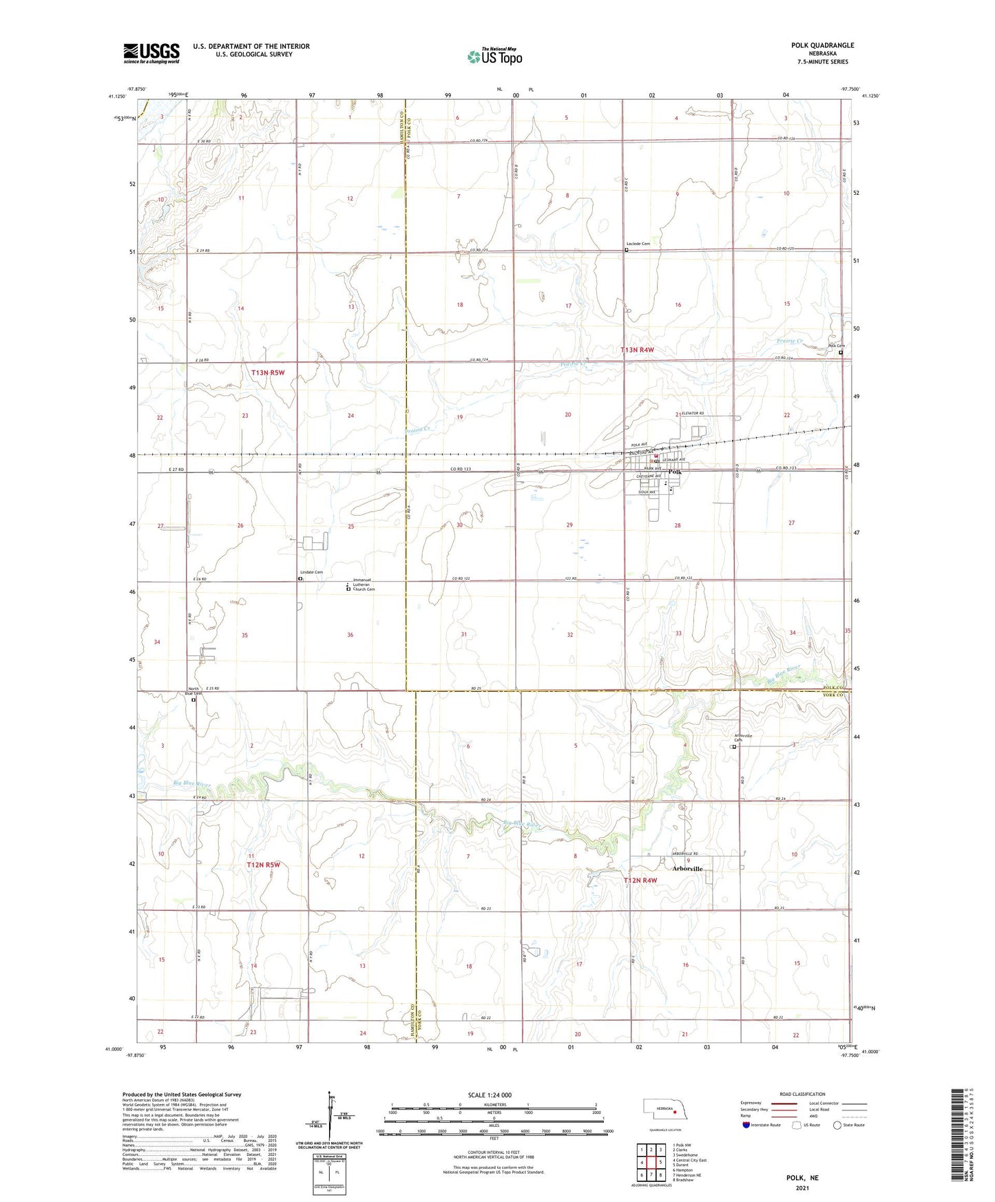
2021 topographic map quadrangle Polk in the state of Nebraska. Scale: 1:24000. Based on the newly updated USGS 7.5' US Topo map series, this map is in the following counties: Hamilton, Polk, York, Merrick. The map contains contour data, water features, and other items you are used to seeing on USGS maps, but also has updated roads and other features. This is the next generation of topographic maps. Printed on high-quality waterproof paper with UV fade-resistant inks.
Quads adjacent to this one:
West: Central City East
Northwest: Polk NW
North: Clarks
Northeast: Swedehome
East: Durant
Southeast: Bradshaw
South: Henderson NE
Southwest: Hampton
Contains the following named places: Arborville, Arborville Cemetery, Arborville Congregational Church, Arborville Election Precinct, Arborville Post Office, Evangelical Free Church of America, First Baptist Church, Immanuel Lutheran Church, Immanuel Lutheran School, Laclede Cemetery, Lindale Cemetery, Merchant Homestead Airport, North Blue Cemetery, Polk, Polk Bible Camp, Polk Cemetery, Polk Fire and Rescue, Polk Post Office, Polk Public Library, Polk-Hordville High School, Swede Plain Church, Township of Arborville, Trinity Lutheran Church, United Co-op Incorporated Elevator, United Methodist Church, Village of Polk, West Pleasant Home Election Precinct, ZIP Code: 68654