MyTopo
Clarks Nebraska US Topo Map
Couldn't load pickup availability
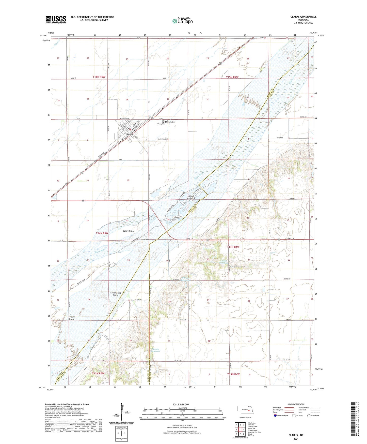
2021 topographic map quadrangle Clarks in the state of Nebraska. Scale: 1:24000. Based on the newly updated USGS 7.5' US Topo map series, this map is in the following counties: Merrick, Polk, Hamilton. The map contains contour data, water features, and other items you are used to seeing on USGS maps, but also has updated roads and other features. This is the next generation of topographic maps. Printed on high-quality waterproof paper with UV fade-resistant inks.
Quads adjacent to this one:
West: Polk NW
Northwest: Fullerton
North: Havens
Northeast: Silver Creek
East: Swedehome
Southeast: Durant
South: Polk
Southwest: Central City East
This map covers the same area as the classic USGS quad with code o41097b7.
Contains the following named places: Ash Island, Bakers Island, Calvary Cemetery, Clarks, Clarks Cemetery, Clarks Post Office, Clarks Public Schools, Clarks Volunteer Fire Department, Clarksville Township Public Library, Congregational Church, Coover Dam, Coover Reservoir, Cottonwood Island, Dittmer Dam, Dittmer Reservoir, Island Number 2, Saint Peter Catholic Church, Stevens Dam, Stevens Reservoir, United Methodist Church, Village of Clarks, ZIP Code: 68628