MyTopo
Powderhorn Valley SW Nebraska US Topo Map
Couldn't load pickup availability
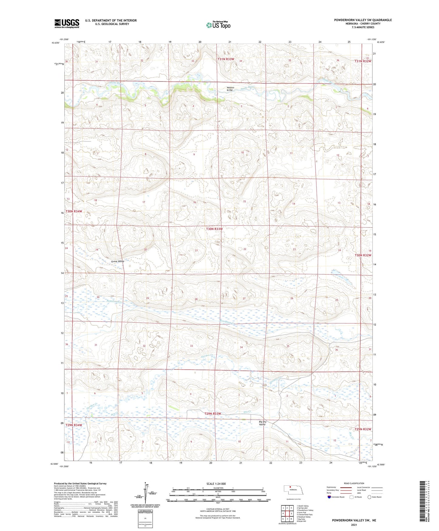
2021 topographic map quadrangle Powderhorn Valley SW in the state of Nebraska. Scale: 1:24000. Based on the newly updated USGS 7.5' US Topo map series, this map is in the following counties: Cherry. The map contains contour data, water features, and other items you are used to seeing on USGS maps, but also has updated roads and other features. This is the next generation of topographic maps. Printed on high-quality waterproof paper with UV fade-resistant inks.
Quads adjacent to this one:
West: Farm Flat
Northwest: Heath Valley
North: Spring Lake
Northeast: Powderhorn Valley
East: Chesterfield Flats
Southeast: Brush Hill
South: Big Falls
Southwest: Rosebud Valley
This map covers the same area as the classic USGS quad with code o42101e2.
Contains the following named places: Barnes Ranch, Lake George, Sherman Pond, Webster Bridge, Wolfenden Ranch, ZIP Code: 69219