MyTopo
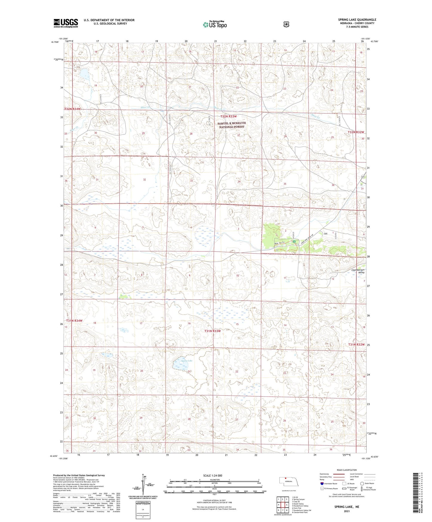
Spring Lake Nebraska US Topo Map
Couldn't load pickup availability
Also explore the Spring Lake Forest Service Topo of this same quad for updated USFS data
2021 topographic map quadrangle Spring Lake in the state of Nebraska. Scale: 1:24000. Based on the newly updated USGS 7.5' US Topo map series, this map is in the following counties: Cherry. The map contains contour data, water features, and other items you are used to seeing on USGS maps, but also has updated roads and other features. This is the next generation of topographic maps. Printed on high-quality waterproof paper with UV fade-resistant inks.
Quads adjacent to this one:
West: Heath Valley
Northwest: Eli SE
North: Spring Canyon
Northeast: Cody SE
East: Powderhorn Valley
Southeast: Chesterfield Flats
South: Powderhorn Valley SW
Southwest: Farm Flat
This map covers the same area as the classic USGS quad with code o42101f2.
Contains the following named places: Adamson Ranch, Burge Ranch, Diamond Bar Ranch, Nicbrara Ranger Station, School Number 116, School Number 166, Shields Ranch, Spring Lake, Steer Creek Campground, Wallingford Ranch