MyTopo
Ravenna Nebraska US Topo Map
Couldn't load pickup availability
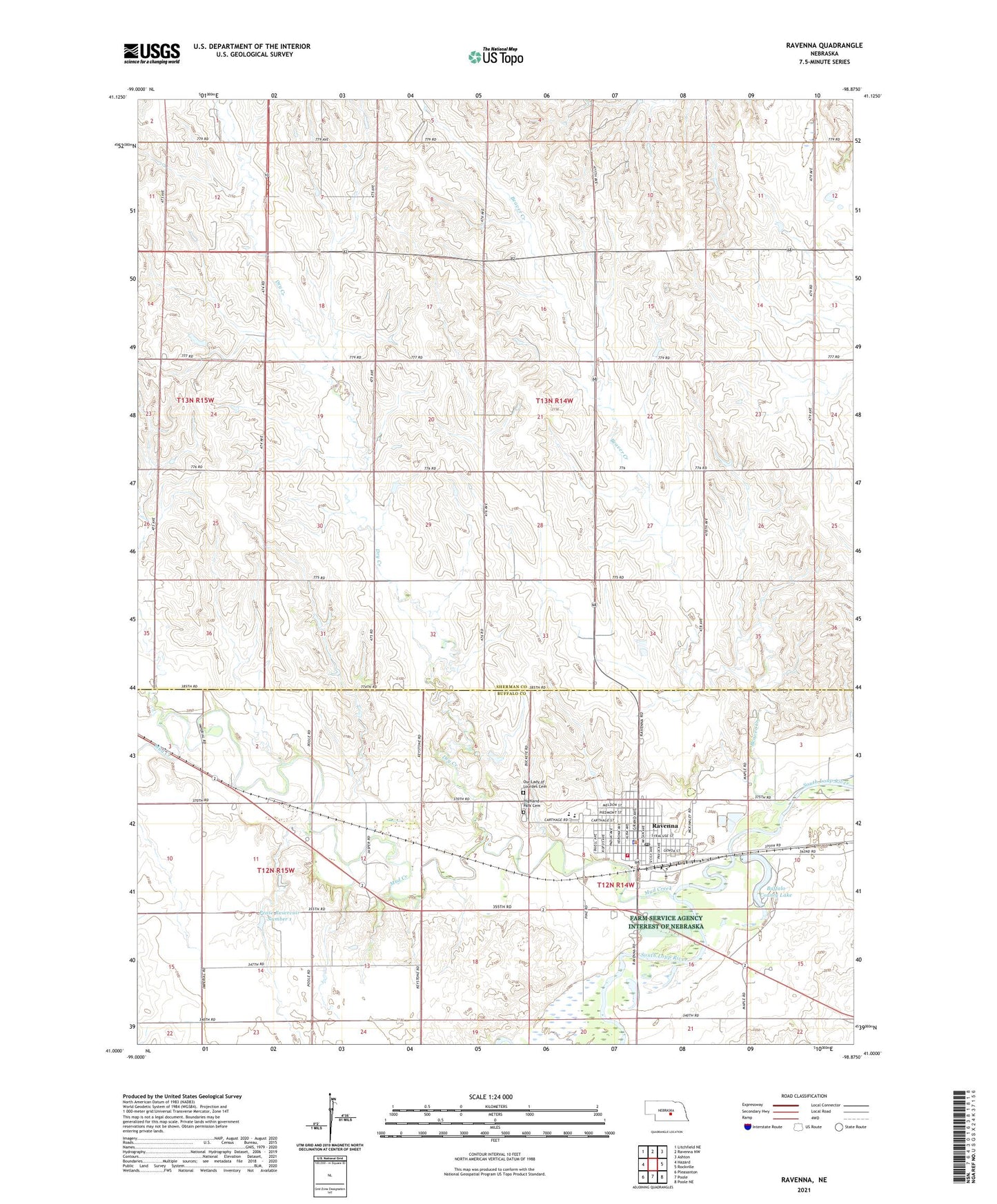
2021 topographic map quadrangle Ravenna in the state of Nebraska. Scale: 1:24000. Based on the newly updated USGS 7.5' US Topo map series, this map is in the following counties: Sherman, Buffalo. The map contains contour data, water features, and other items you are used to seeing on USGS maps, but also has updated roads and other features. This is the next generation of topographic maps. Printed on high-quality waterproof paper with UV fade-resistant inks.
Quads adjacent to this one:
West: Hazard
Northwest: Litchfield NE
North: Ravenna NW
Northeast: Ashton
East: Rockville
Southeast: Poole NE
South: Poole
Southwest: Pleasanton
Contains the following named places: Beaver Creek, Bethlehem Lutheran Church, Buffalo County Lake, Cargill Incorporated Elevator, CCC Camp Ravenna Nebraska Historical Marker, City of Ravenna, Dry Creek, Election Precinct 18, Fairview School, Good Samaritan Center, Habe School, Halvik School, Highland Park Cemetery, Kuhl School, Mud Creek, Our Lady of Lourdes Catholic Church, Our Lady of Lourdes Cemetery, Pease Dam Number 1, Pease Reservoir Number 1, Post South Loup Fork 'Fort Banishment' Historical Marker, Ravenna, Ravenna Emergency Unit, Ravenna Golf Club, Ravenna Lake State Recreation Area, Ravenna Medical Clinic, Ravenna Post Office, Ravenna Public Library, Ravenna Public Schools, Ravenna State Lake Dam, Ravenna Volunteer Fire Department, Rockville Election Precinct, School Number 75, Township of Bristol, Township of Garfield, United Church of Christ, United Methodist Church, West Ravenna