
MyTopo
Riverton Nebraska US Topo Map
Couldn't load pickup availability
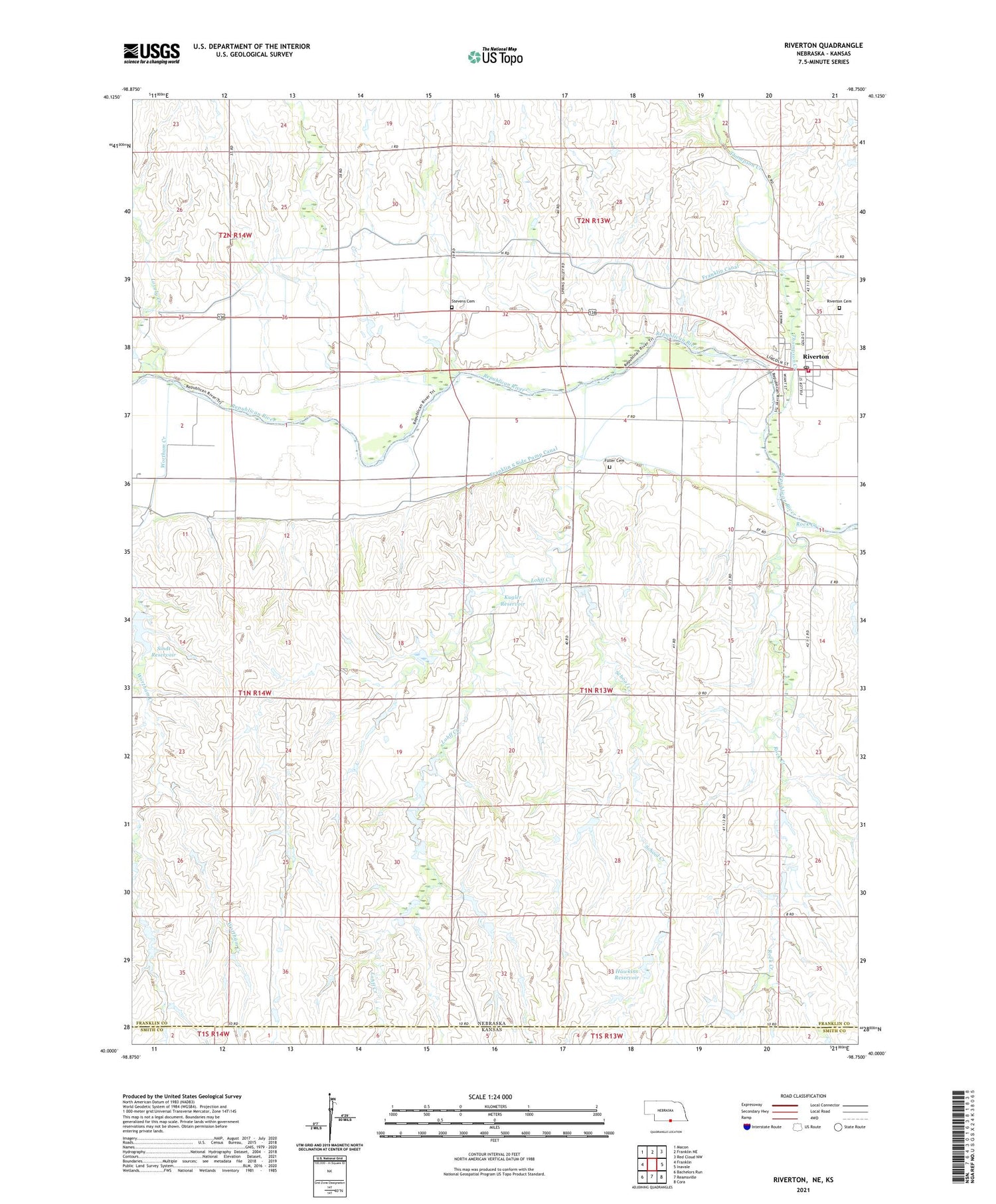
2021 topographic map quadrangle Riverton in the state of Nebraska. Scale: 1:24000. Based on the newly updated USGS 7.5' US Topo map series, this map is in the following counties: Franklin, Smith. The map contains contour data, water features, and other items you are used to seeing on USGS maps, but also has updated roads and other features. This is the next generation of topographic maps. Printed on high-quality waterproof paper with UV fade-resistant inks.
Quads adjacent to this one:
West: Franklin
Northwest: Macon
North: Franklin NE
Northeast: Red Cloud NW
East: Inavale
Southeast: Cora
South: Reamsville
Southwest: Bachelors Run
This map covers the same area as the classic USGS quad with code o40098a7.
Contains the following named places: Assembly of God Church, Franklin South Side Pump Canal, Fuller Cemetery, Hawkins Dam, Hawkins Reservoir, Kugler Dam, Kugler Reservoir, Lohff Creek, Lovely Creek, Riverton, Riverton Post Office, Riverton Public School, Riverton Volunteer Fire Department, Rock Creek, Saint Catherine Catholic Church, School Creek, Sindt Dam, Sindt Reservoir, Stevens Cemetery, Thompson Creek, Township of Washington, United Church of Christ, Village of Riverton, Wortham Creek, ZIP Code: 68972


