MyTopo
Inavale Nebraska US Topo Map
Couldn't load pickup availability
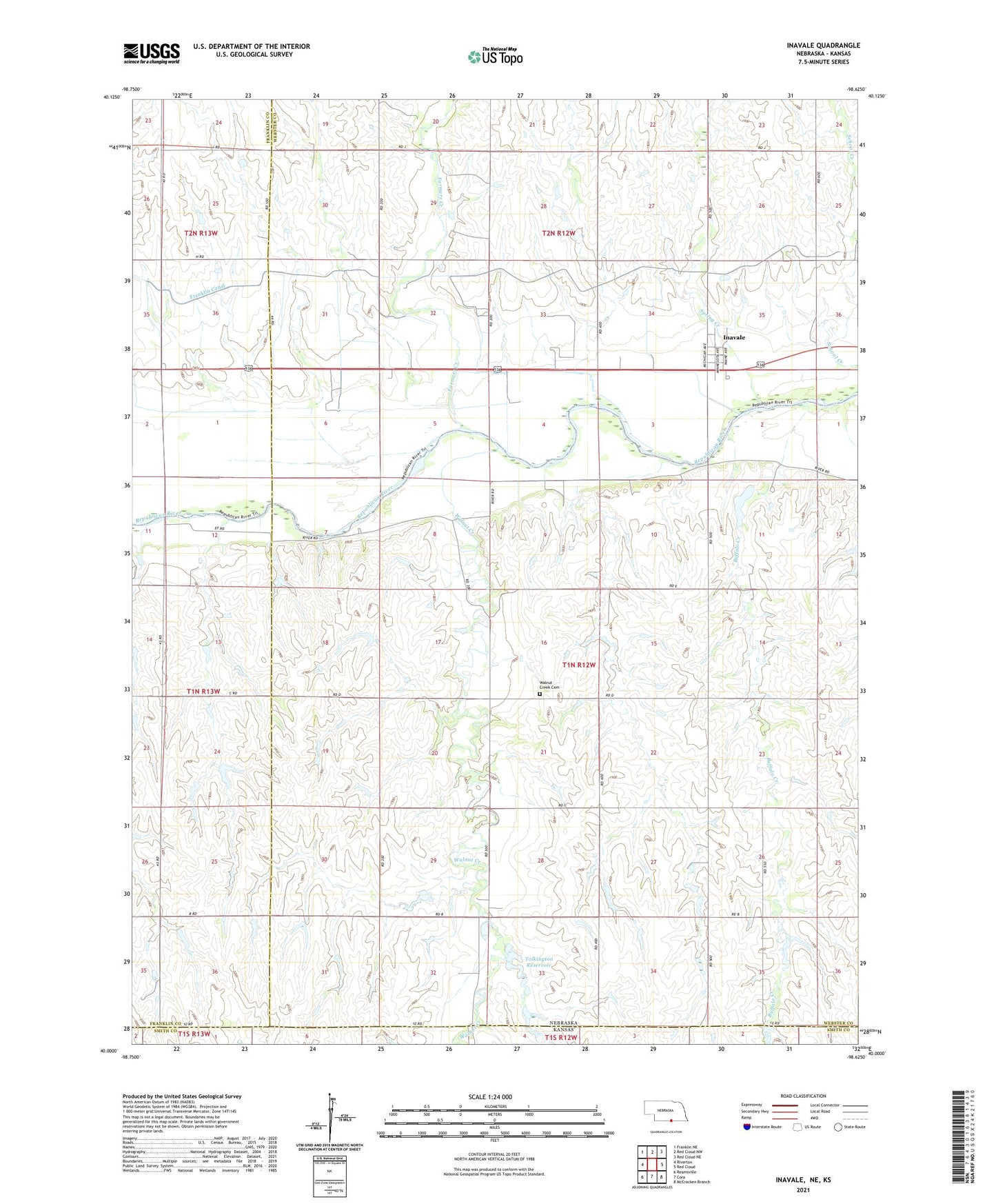
2021 topographic map quadrangle Inavale in the state of Nebraska. Scale: 1:24000. Based on the newly updated USGS 7.5' US Topo map series, this map is in the following counties: Webster, Franklin, Smith. The map contains contour data, water features, and other items you are used to seeing on USGS maps, but also has updated roads and other features. This is the next generation of topographic maps. Printed on high-quality waterproof paper with UV fade-resistant inks.
Quads adjacent to this one:
West: Riverton
Northwest: Franklin NE
North: Red Cloud NW
Northeast: Red Cloud NE
East: Red Cloud
Southeast: McCracken Branch
South: Cora
Southwest: Reamsville
This map covers the same area as the classic USGS quad with code o40098a6.
Contains the following named places: Buffalo Creek, Dry Creek, Farmers Creek, Gala Gardens Manor, Inavale, Inavale Census Designated Place, Inavale Post Office, M and N Grain Incorporated Elevator, Spring Creek, Talkington Dam, Talkington Reservoir, Walnut Creek, Walnut Creek Cemetery, ZIP Code: 68952