MyTopo
Rushville Nebraska US Topo Map
Couldn't load pickup availability
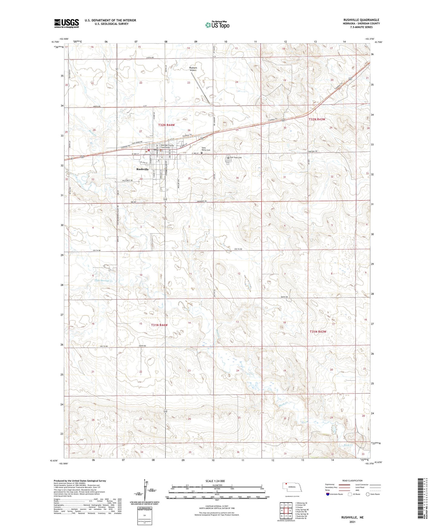
2021 topographic map quadrangle Rushville in the state of Nebraska. Scale: 1:24000. Based on the newly updated USGS 7.5' US Topo map series, this map is in the following counties: Sheridan. The map contains contour data, water features, and other items you are used to seeing on USGS maps, but also has updated roads and other features. This is the next generation of topographic maps. Printed on high-quality waterproof paper with UV fade-resistant inks.
Quads adjacent to this one:
West: Hay Springs NE
Northwest: Whiteclay SE
North: Clinton SW
Northeast: Clinton
East: Rushville NE
Southeast: Rushville SE
South: Rushville SW
Southwest: Hay Springs SE
This map covers the same area as the classic USGS quad with code o42102f4.
Contains the following named places: Benschoter Memorial Library, City of Rushville, Fair View Cemetery, Farmers Co-op Elevator Company Elevator, Immaculate Conception Church, Lockmon RV Trailer Park, Modisett Airport, Parkview Lodge Nursing Home, Prairie View School, Rushville, Rushville Clinic, Rushville Elementary School, Rushville High School, Rushville Historical Marker, Rushville Junior High School, Rushville Police Department, Rushville Post Office, Rushville Public Library, Rushville Volunteer Fire and Rescue, Saint Marys Cemetery, Saint Pauls Lutheran Church, Sand Ridge Golf Course, Sandy Knoll School, Sheridan County Courthouse, Sheridan County Historical Museum, Sheridan County Sheriff's Office, South Rushville Election Precinct, United Methodist Church, ZIP Code: 69360