MyTopo
Rushville SW Nebraska US Topo Map
Couldn't load pickup availability
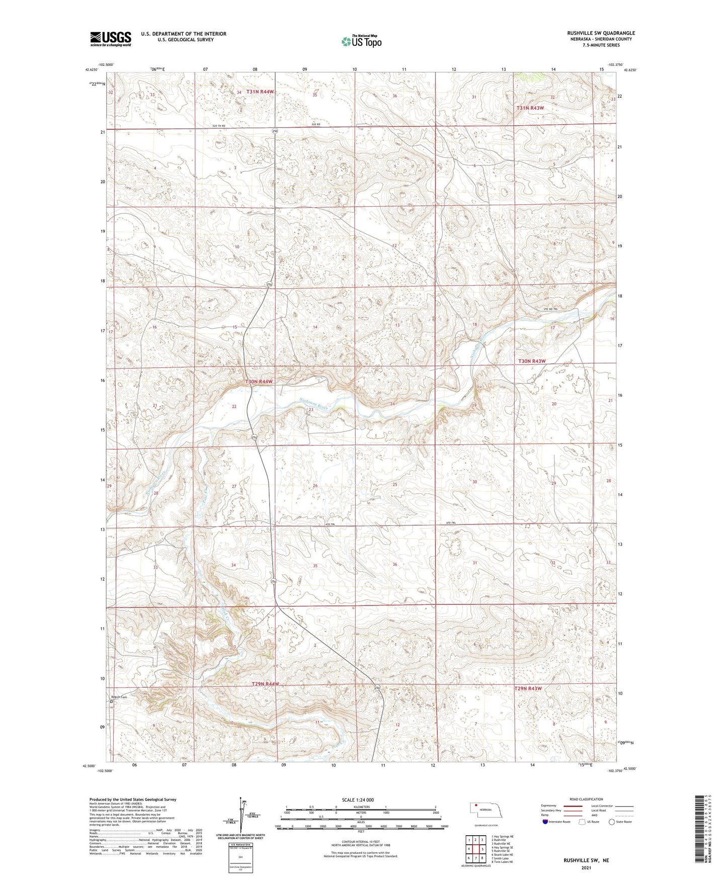
2021 topographic map quadrangle Rushville SW in the state of Nebraska. Scale: 1:24000. Based on the newly updated USGS 7.5' US Topo map series, this map is in the following counties: Sheridan. The map contains contour data, water features, and other items you are used to seeing on USGS maps, but also has updated roads and other features. This is the next generation of topographic maps. Printed on high-quality waterproof paper with UV fade-resistant inks.
Quads adjacent to this one:
West: Hay Springs SE
Northwest: Hay Springs NE
North: Rushville
Northeast: Rushville NE
East: Rushville SE
Southeast: Twin Lakes NE
South: Smith Lake
Southwest: Skunk Lake NE
This map covers the same area as the classic USGS quad with code o42102e4.
Contains the following named places: Beguin Cemetery, Colcesser Post Office, Hillview School, Mill School, Missouri Valley Public School, Pine Creek, Sheridan County