MyTopo
Saint Libory Nebraska US Topo Map
Couldn't load pickup availability
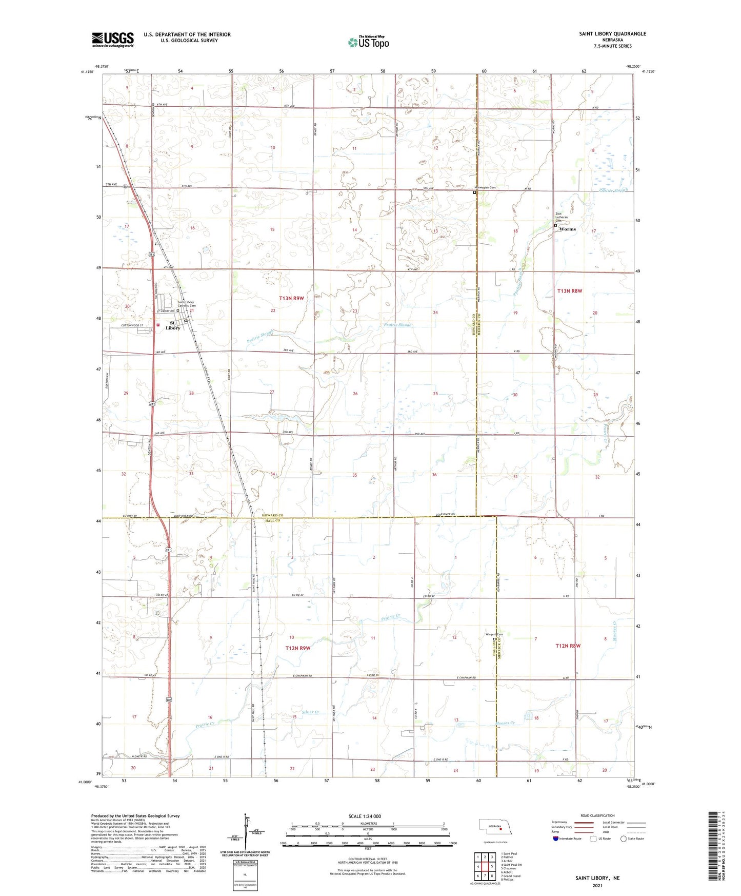
2021 topographic map quadrangle Saint Libory in the state of Nebraska. Scale: 1:24000. Based on the newly updated USGS 7.5' US Topo map series, this map is in the following counties: Howard, Merrick, Hall. The map contains contour data, water features, and other items you are used to seeing on USGS maps, but also has updated roads and other features. This is the next generation of topographic maps. Printed on high-quality waterproof paper with UV fade-resistant inks.
Quads adjacent to this one:
West: Saint Paul SW
Northwest: Saint Paul
North: Palmer
Northeast: Archer
East: Chapman
Southeast: Phillips
South: Grand Island
Southwest: Abbott
Contains the following named places: Emmanuel Church, Norwegian Cemetery, Pleasant Ridge School, Saint Libory, Saint Libory Census Designated Place, Saint Libory Election Precinct, Saint Libory Elementary School, Saint Libory Post Office, Saint Libory Volunteer Fire and Rescue, Saint Liborys Catholic Church, School Number 26, School Number 41, School Number 56, School Number 71, Silver Creek, Township of Lake, Township of Saint Libory, Union Grain Company Elevator, Wiegert Cemetery, Worms, Worms Post Office, Zion Lutheran Church, Zion Lutheran School, ZIP Code: 68872