MyTopo
Palmer Nebraska US Topo Map
Couldn't load pickup availability
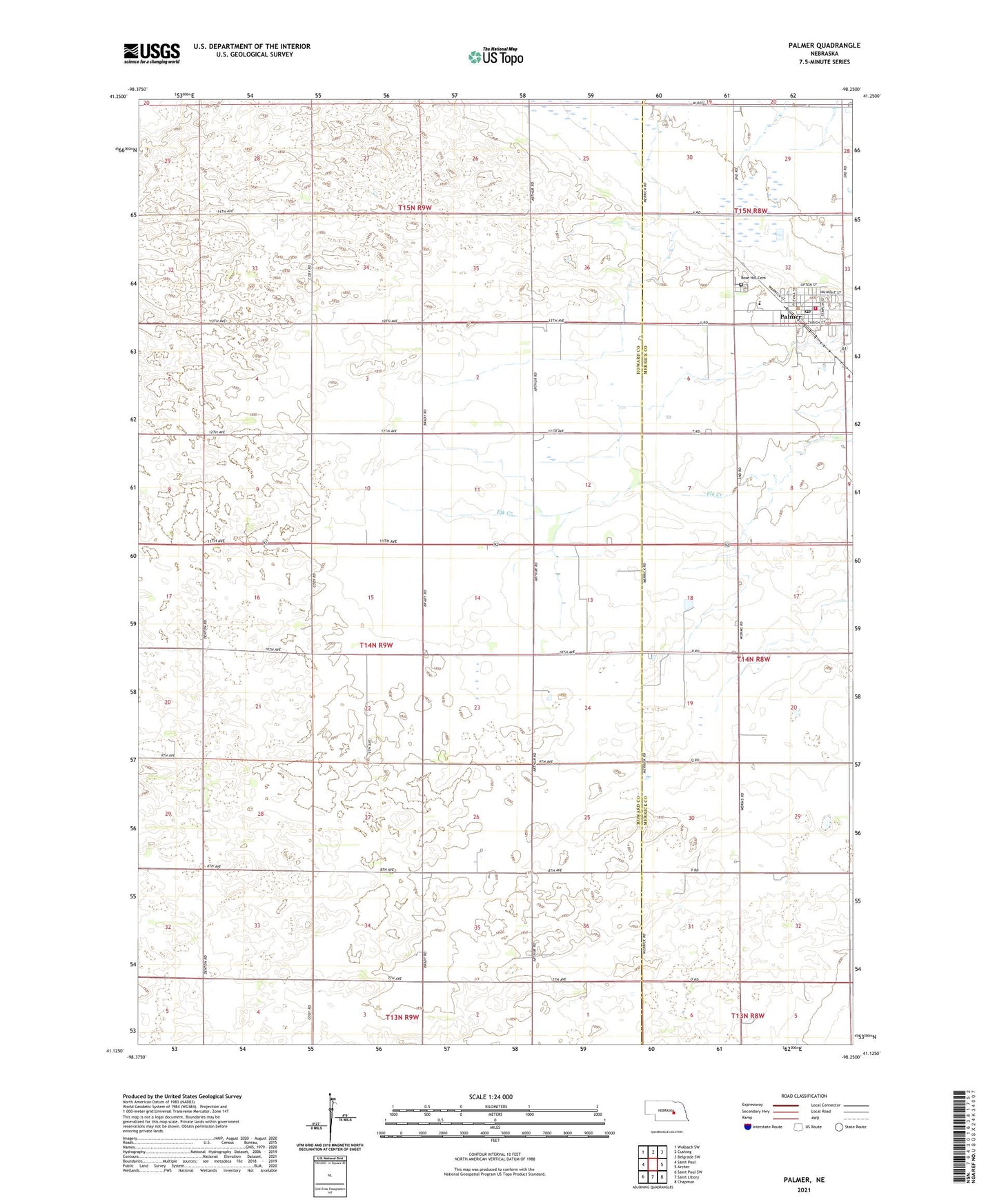
2021 topographic map quadrangle Palmer in the state of Nebraska. Scale: 1:24000. Based on the newly updated USGS 7.5' US Topo map series, this map is in the following counties: Howard, Merrick. The map contains contour data, water features, and other items you are used to seeing on USGS maps, but also has updated roads and other features. This is the next generation of topographic maps. Printed on high-quality waterproof paper with UV fade-resistant inks.
Quads adjacent to this one:
West: Saint Paul
Northwest: Wolbach SW
North: Cushing
Northeast: Belgrade SW
East: Archer
Southeast: Chapman
South: Saint Libory
Southwest: Saint Paul SW
This map covers the same area as the classic USGS quad with code o41098b3.
Contains the following named places: Coolidge Center Nursing Home, First Church of Christ, Gage Valley Election Precinct, Palmer, Palmer Post Office, Palmer Public Library, Palmer Public Schools, Palmer Rural Fire District, Rose Hill Cemetery, Saint Johns Lutheran Church, School Number 19, School Number 39, School Number 64, Township of Gage Valley, United Methodist Church, Village of Palmer, Wesleyan Church