MyTopo
Salem Nebraska US Topo Map
Couldn't load pickup availability
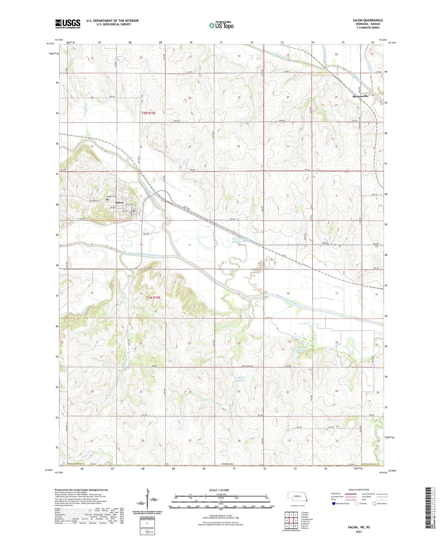
2021 topographic map quadrangle Salem in the state of Nebraska. Scale: 1:24000. Based on the newly updated USGS 7.5' US Topo map series, this map is in the following counties: Richardson, Brown. The map contains contour data, water features, and other items you are used to seeing on USGS maps, but also has updated roads and other features. This is the next generation of topographic maps. Printed on high-quality waterproof paper with UV fade-resistant inks.
Quads adjacent to this one:
West: Humboldt SE
Northwest: Dawson
North: Verdon
Northeast: Barada
East: Falls City
Southeast: Reserve
South: Morrill
Southwest: Sabetha
Contains the following named places: Campbell Dam, Campbell Reservoir, Contrary Creek, Deer Branch, Falls Church, Falls City Country Club, Falls City Oil Field, First Oil Well Historical Marker, Five Point School, Freeling, Gladstone School, Goolsby Branch, Mackelroy Creek, Maple Cemetery, North Fork Big Nemaha River, Old Channel Big Nemaha River, Pedee Creek, Pleasant Ridge School, Rock Creek, Saint Marks Church, Salem, Salem Election Precinct, Salem Grain Company Elevator, Salem Post Office, Salem Volunteer Fire Department, South Fork Big Nemaha River, Straussville, Straussville Grain Incorporated Elevator, Straussville Post Office, Towle-Martin Dam, Towle-Martin Reservoir, Township of Falls City, Township of Salem, Village of Salem, Wildcat Creek, ZIP Code: 68433