MyTopo
Seneca Nebraska US Topo Map
Couldn't load pickup availability
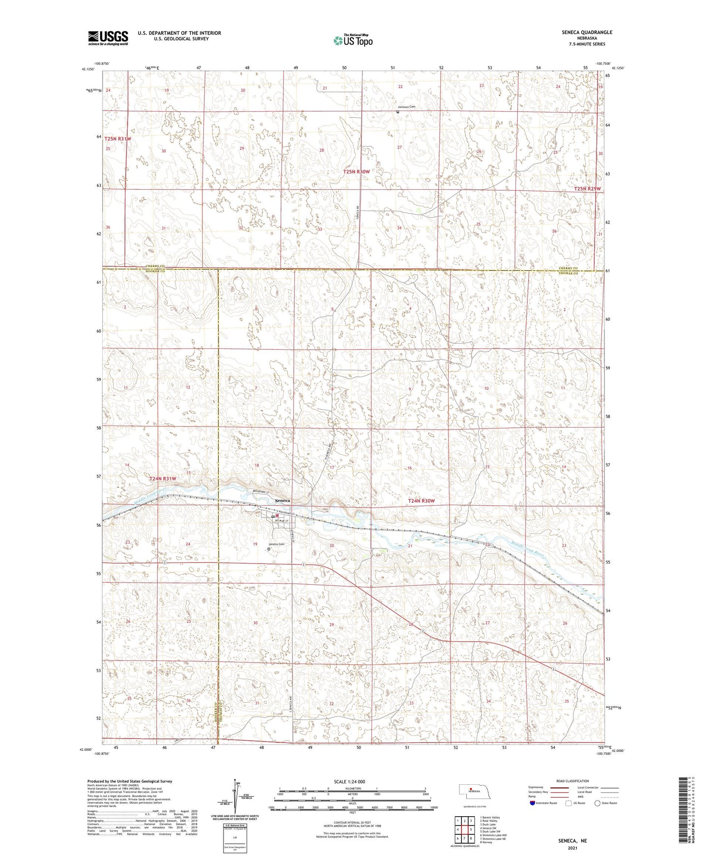
2021 topographic map quadrangle Seneca in the state of Nebraska. Scale: 1:24000. Based on the newly updated USGS 7.5' US Topo map series, this map is in the following counties: Thomas, Cherry, Hooker. The map contains contour data, water features, and other items you are used to seeing on USGS maps, but also has updated roads and other features. This is the next generation of topographic maps. Printed on high-quality waterproof paper with UV fade-resistant inks.
Quads adjacent to this one:
West: Seneca SW
Northwest: Barent Valley
North: Rose Valley
Northeast: Duck Lake
East: Duck Lake SW
Southeast: Norway
South: Shimmins Lake NE
Southwest: Shimmins Lake NW
This map covers the same area as the classic USGS quad with code o42100a7.
Contains the following named places: Crawford Ranch, Edelman Ranch, Hardy Ranch, Red Ranch, Seneca, Seneca Census Designated Place, Seneca Post Office, Seneca Volunteer Fire Department, United Church of Christ, Van Dusen Ranch, Village of Seneca, Walker Ranch, West Seneca