MyTopo
Stegall Nebraska US Topo Map
Couldn't load pickup availability
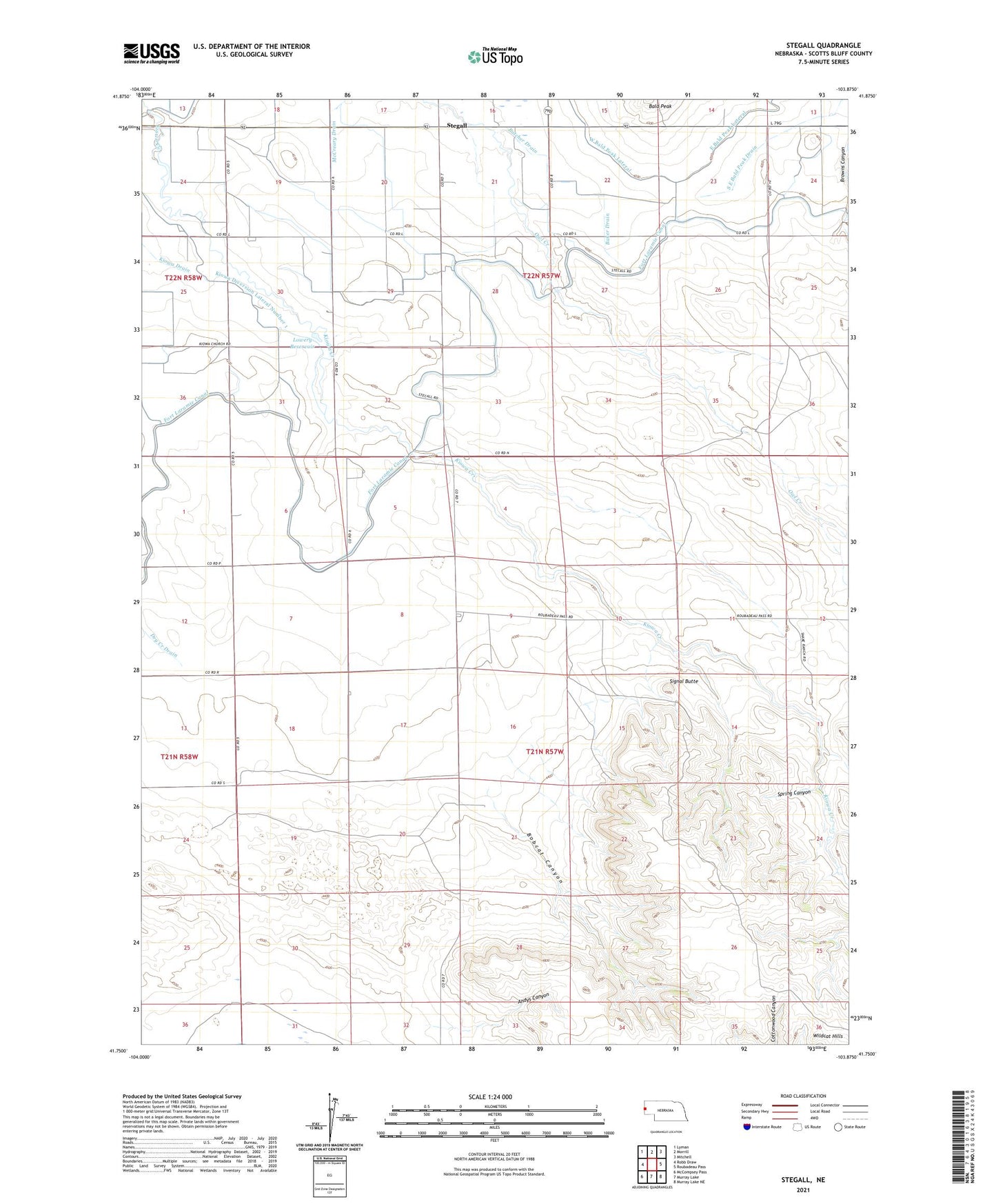
2021 topographic map quadrangle Stegall in the state of Nebraska. Scale: 1:24000. Based on the newly updated USGS 7.5' US Topo map series, this map is in the following counties: Scotts Bluff. The map contains contour data, water features, and other items you are used to seeing on USGS maps, but also has updated roads and other features. This is the next generation of topographic maps. Printed on high-quality waterproof paper with UV fade-resistant inks.
Quads adjacent to this one:
West: Robb Draw
Northwest: Lyman
North: Morrill
Northeast: Mitchell
East: Roubadeau Pass
Southeast: Murray Lake NE
South: Murray Lake
Southwest: McCompsey Pass
Contains the following named places: Andys Canyon, Baker Drain, Bobcat Canyon, Browns Canyon Dam Number 1, Browns Canyon Reservoir Number 1, Butcher Drain, East Bald Peak Drain, Kiowa Community Church, Kiowa Diversion Lateral Number 1, Kiowa Diversion Lateral Number 2, Kiowa Drain, Kiowa Election Precinct, Lowery Reservoir, McCreary Drain, Owl Creek School, Signal Butte, Spring Canyon, Stegall, Wheatland School, ZIP Code: 69352