MyTopo
Robb Draw Wyoming US Topo Map
Couldn't load pickup availability
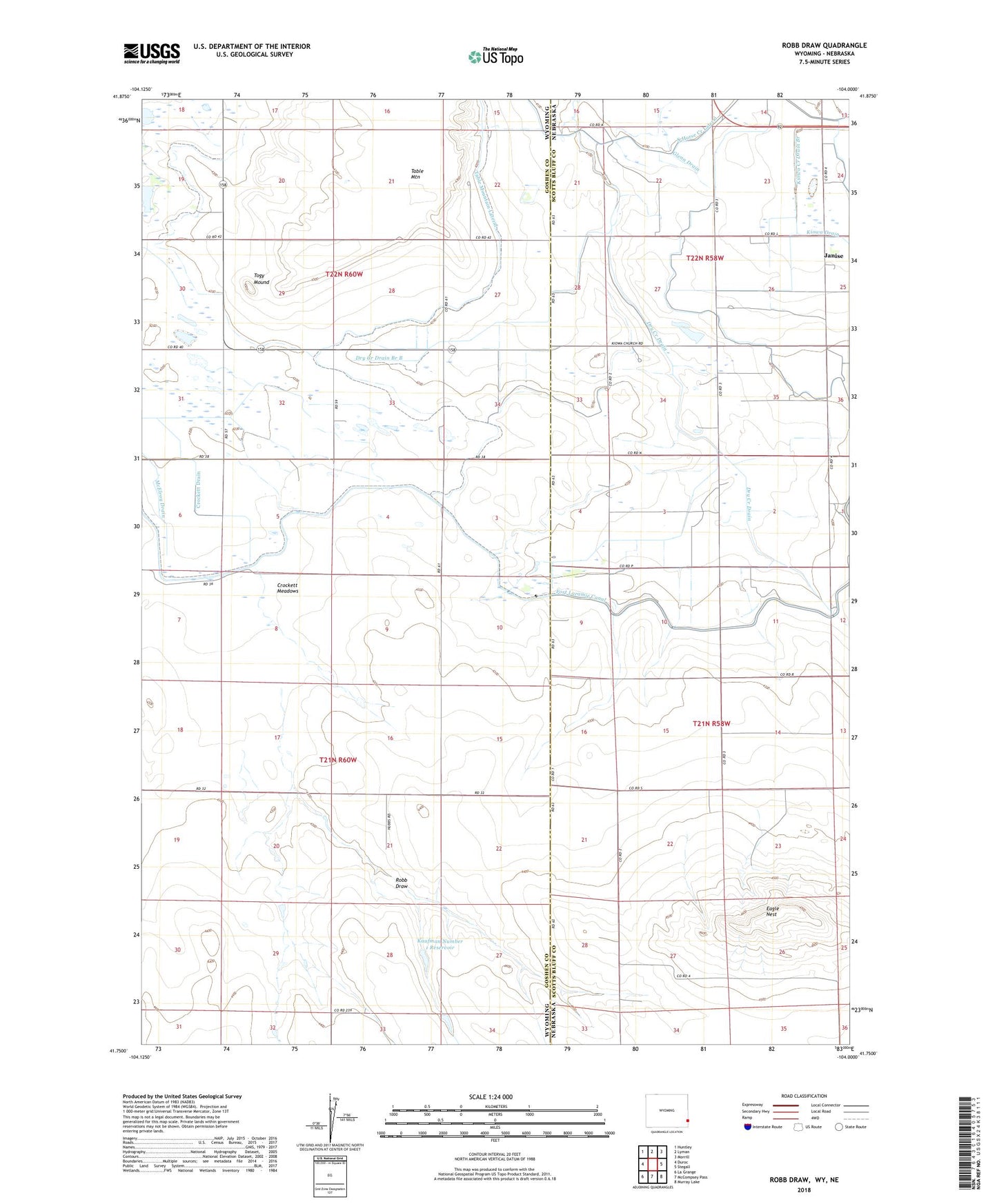
2021 topographic map quadrangle Robb Draw in the states of Wyoming, Nebraska. Scale: 1:24000. Based on the newly updated USGS 7.5' US Topo map series, this map is in the following counties: Goshen, Scotts Bluff. The map contains contour data, water features, and other items you are used to seeing on USGS maps, but also has updated roads and other features. This is the next generation of topographic maps. Printed on high-quality waterproof paper with UV fade-resistant inks.
Quads adjacent to this one:
West: Duroc
Northwest: Huntley
North: Lyman
Northeast: Morrill
East: Stegall
Southeast: Murray Lake
South: McCompsey Pass
Southwest: La Grange
This map covers the same area as the classic USGS quad with code o41104g1.
Contains the following named places: Crockett Drain, Crockett Meadows, Dry Creek Drain, Dry Creek Drain Branch B, Eagle Nest, Glenn Drain, Janise, Kaufman Number 1 Dam, Kaufman Number 1 Reservoir, Kiowa Creek Drain Branch, Kiowa School, McElroy Drain, Robb Draw, Standard School, Table Mountain Lateral, Togy Mound