MyTopo
McCompsey Pass Wyoming US Topo Map
Couldn't load pickup availability
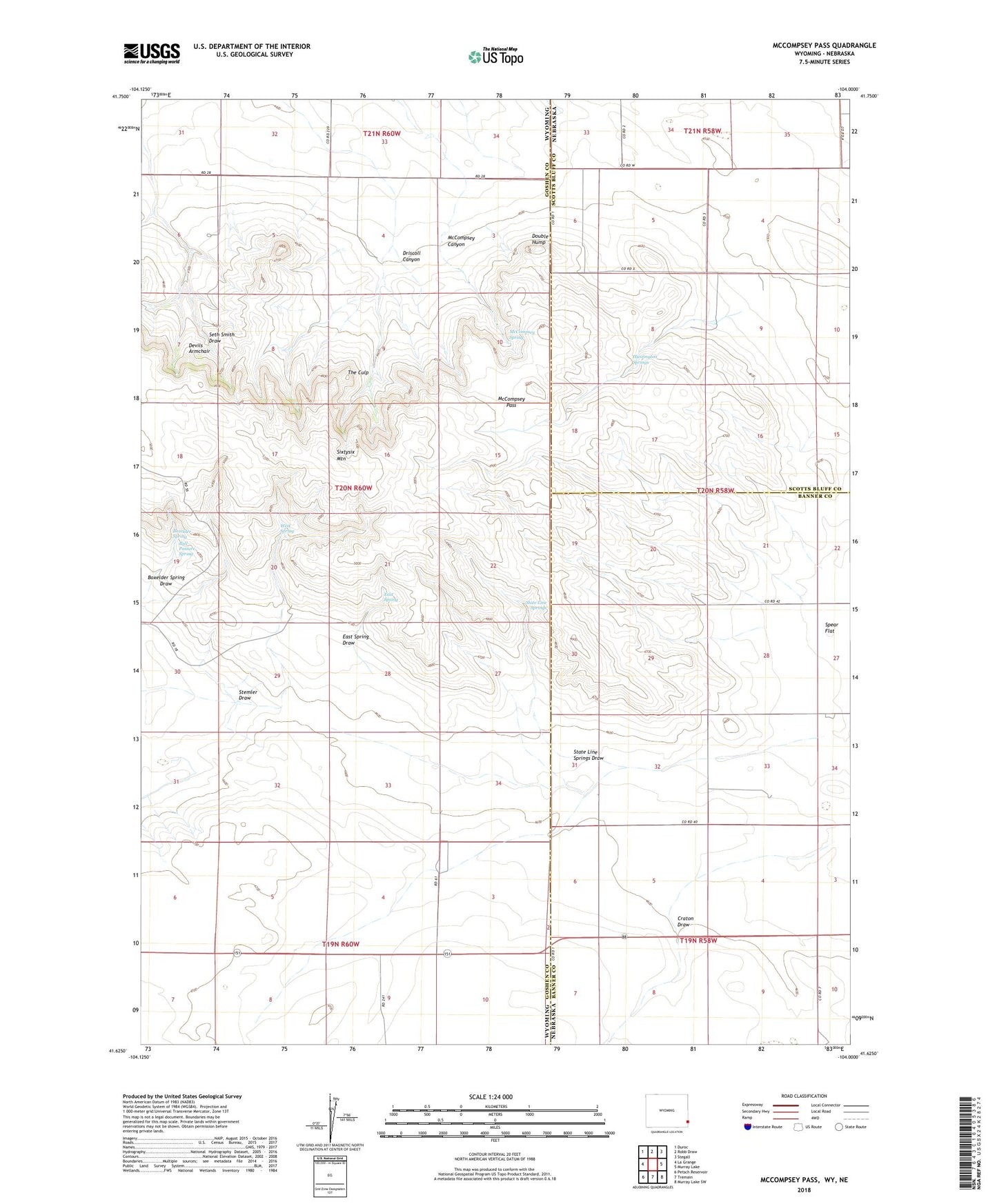
2021 topographic map quadrangle McCompsey Pass in the states of Wyoming, Nebraska. Scale: 1:24000. Based on the newly updated USGS 7.5' US Topo map series, this map is in the following counties: Goshen, Banner, Scotts Bluff. The map contains contour data, water features, and other items you are used to seeing on USGS maps, but also has updated roads and other features. This is the next generation of topographic maps. Printed on high-quality waterproof paper with UV fade-resistant inks.
Quads adjacent to this one:
West: La Grange
Northwest: Duroc
North: Robb Draw
Northeast: Stegall
East: Murray Lake
Southeast: Murray Lake SW
South: Tremain
Southwest: Petsch Reservoir
This map covers the same area as the classic USGS quad with code o41104f1.
Contains the following named places: 66 Pastures Dam, 66 Pastures Reservoir, Boxelder Spring, Boxelder Spring Draw, Bull Pasture Spring, Craton Draw, Devils Armchair, Double Hump, Driscoll Canyon, East Spring, East Spring Draw, Huntington Springs, McCompsey Canyon, McCompsey Pass, McCompsey Spring, Sixtysix Mountain, Spear Flat, State Line Springs, State Line Springs Draw, Stemler Draw, The Culp, West Spring