MyTopo
Table Rock Nebraska US Topo Map
Couldn't load pickup availability
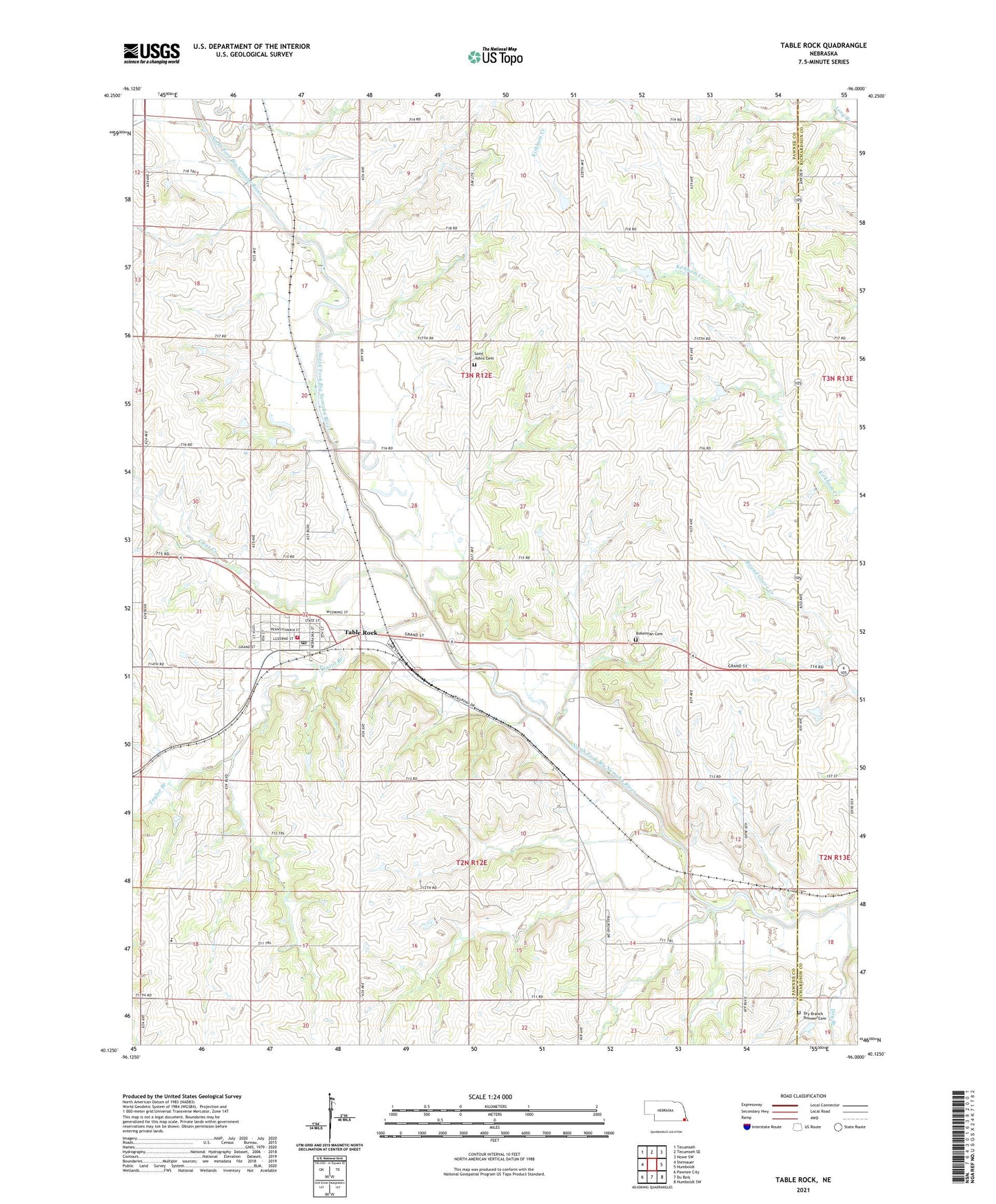
2021 topographic map quadrangle Table Rock in the state of Nebraska. Scale: 1:24000. Based on the newly updated USGS 7.5' US Topo map series, this map is in the following counties: Pawnee, Richardson. The map contains contour data, water features, and other items you are used to seeing on USGS maps, but also has updated roads and other features. This is the next generation of topographic maps. Printed on high-quality waterproof paper with UV fade-resistant inks.
Quads adjacent to this one:
West: Steinauer
Northwest: Tecumseh
North: Tecumseh SE
Northeast: Howe SW
East: Humboldt
Southeast: Humboldt SW
South: Du Bois
Southwest: Pawnee City
Contains the following named places: Appleton, Bohemian Cemetery, Clear Creek, Dry Branch, Dry Branch Pioneer Cemetery, Election Precinct 3 Table Rock, Midwest Grain Company Elevator, Saint Johns Cemetery, Searcey Grain Company Elevator, Table Rock, Table Rock - Steinauer Schools, Table Rock Dental Clinic, Table Rock Post Office, Table Rock Public Library, Table Rock State Wildlife Management Area, Table Rock United Methodist Church, Table Rock Volunteer Fire Department, Taylor Branch, Taylors Branch State Wildlife Management Area, Township of Sheridan, Township of Table Rock, Village of Table Rock, ZIP Code: 68447