MyTopo
Pawnee City Nebraska US Topo Map
Couldn't load pickup availability
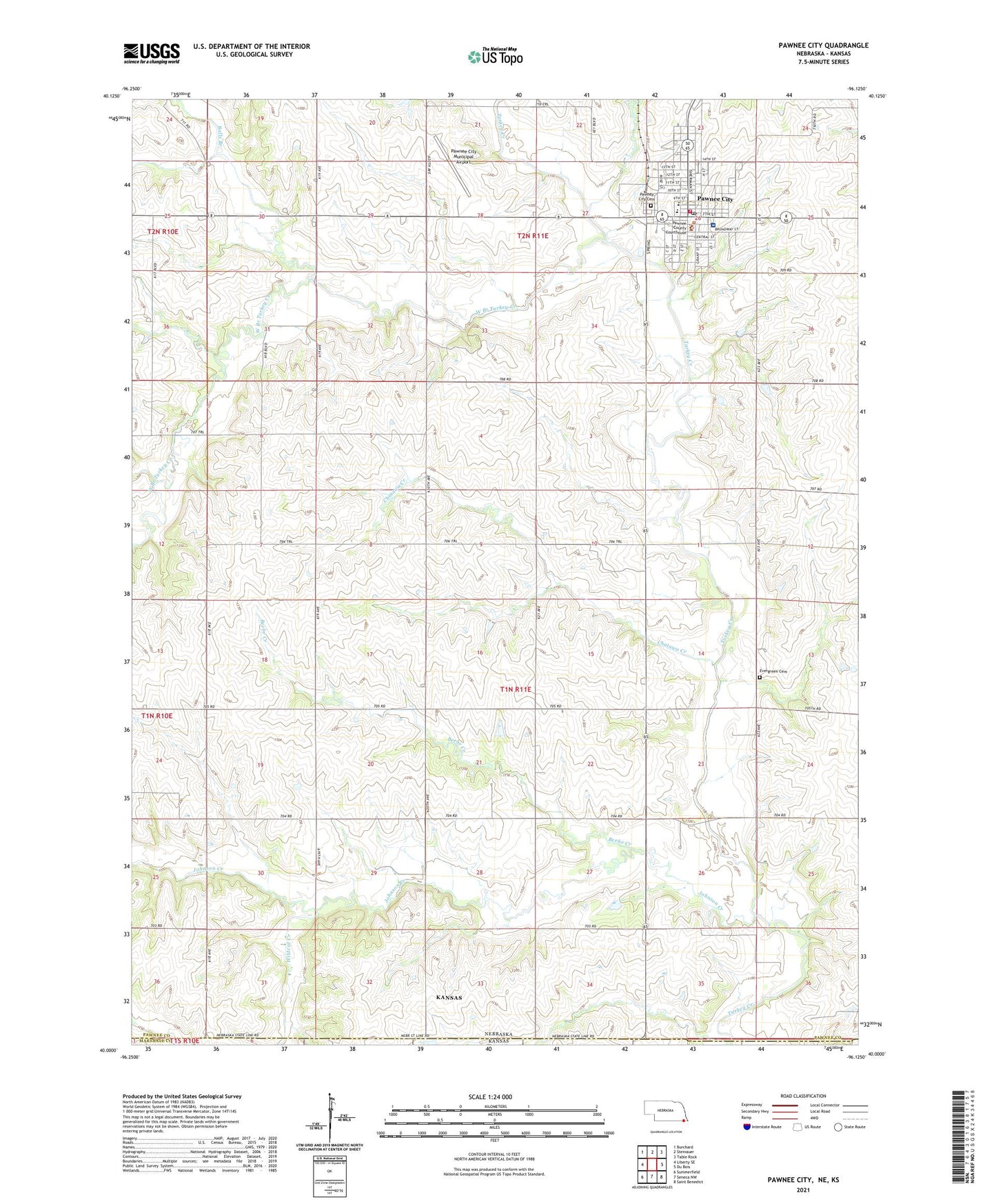
2021 topographic map quadrangle Pawnee City in the state of Nebraska. Scale: 1:24000. Based on the newly updated USGS 7.5' US Topo map series, this map is in the following counties: Pawnee, Nemaha, Marshall. The map contains contour data, water features, and other items you are used to seeing on USGS maps, but also has updated roads and other features. This is the next generation of topographic maps. Printed on high-quality waterproof paper with UV fade-resistant inks.
Quads adjacent to this one:
West: Liberty SE
Northwest: Burchard
North: Steinauer
Northeast: Table Rock
East: Du Bois
Southeast: Saint Benedict
South: Seneca NW
Southwest: Summerfield
This map covers the same area as the classic USGS quad with code o40096a2.
Contains the following named places: Balls Branch, Barker School, Beebe Creek, Chatawa Creek, Christian Church, City of Pawnee City, Evergreen Cemetery, Eyecare Specialties, Faith Baptist Church, First Baptist Church, Grave Hill School, Green Dale School, Johnson Creek, Pawnee City, Pawnee City Carnegie Public Library, Pawnee City Elementary School, Pawnee City Fire Department, Pawnee City Historical Society Museum, Pawnee City Municipal Airport, Pawnee City Post Office, Pawnee County Ambulance Incorporation, Pawnee County Courthouse, Pawnee County Fairground, Pawnee County Memorial Hospital, Pawnee County Rural Health Clinic, Pawnee County Sheriff's Office, Pawnee Manor Incorporated, Pleasant Hill School, Rosinweed School, Schilling Grain Incorporated Elevator, South Park, Township of Clay, Turkey Creek, United Methodist Church, United Presbyterian Church, West Branch Turkey Creek, Wildcat Creek, Zion Lutheran Church, ZIP Code: 68420