MyTopo
Steinauer Nebraska US Topo Map
Couldn't load pickup availability
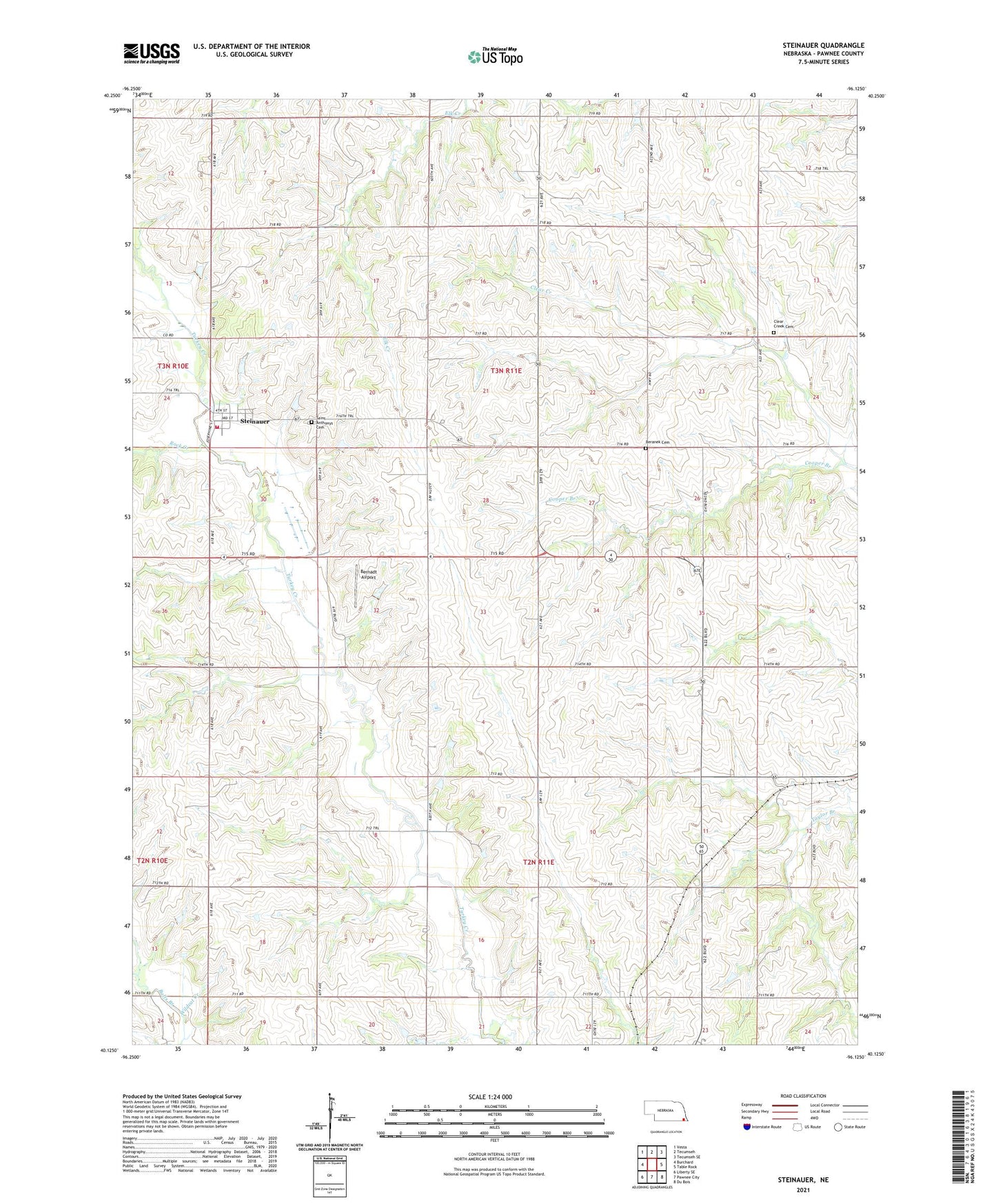
2021 topographic map quadrangle Steinauer in the state of Nebraska. Scale: 1:24000. Based on the newly updated USGS 7.5' US Topo map series, this map is in the following counties: Pawnee. The map contains contour data, water features, and other items you are used to seeing on USGS maps, but also has updated roads and other features. This is the next generation of topographic maps. Printed on high-quality waterproof paper with UV fade-resistant inks.
Quads adjacent to this one:
West: Burchard
Northwest: Vesta
North: Tecumseh
Northeast: Tecumseh SE
East: Table Rock
Southeast: Du Bois
South: Pawnee City
Southwest: Liberty SE
This map covers the same area as the classic USGS quad with code o40096b2.
Contains the following named places: Balls Branch, Beranek Cemetery, Bernadt Airport, Bowwood State Wildlife Management Area, Clear Creek Cemetery, Cold Point School, Cooper Branch, Election Precinct 2 Pawnee Number 2, Gottula Trailer Park, Pawnee County, Rock Creek, Saint Anthony Catholic Church, Saint Anthonys Cemetery, Steinauer, Steinauer Post Office, Steinauer Volunteer Fire Department, Township of Clear Creek, Township of Pawnee, Village of Steinauer, Village of Steinauer Historical Marker, ZIP Code: 68441