MyTopo
Tekamah Nebraska US Topo Map
Couldn't load pickup availability
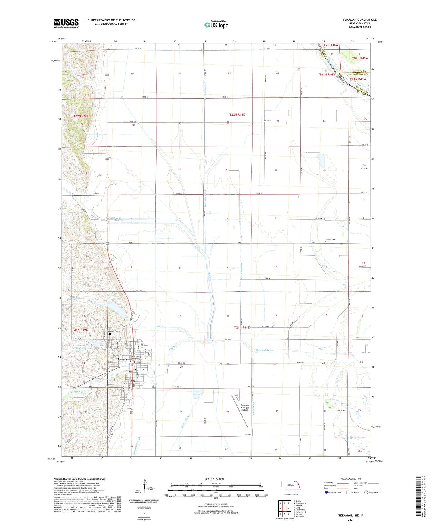
2021 topographic map quadrangle Tekamah in the state of Nebraska. Scale: 1:24000. Based on the newly updated USGS 7.5' US Topo map series, this map is in the following counties: Burt, Monona, Harrison. The map contains contour data, water features, and other items you are used to seeing on USGS maps, but also has updated roads and other features. This is the next generation of topographic maps. Printed on high-quality waterproof paper with UV fade-resistant inks.
Quads adjacent to this one:
West: Craig
Northwest: Bertha
North: Tekamah NW
Northeast: Blencoe
East: Little Sioux
Southeast: Mondamin
South: Herman
Southwest: Nickerson NE
Contains the following named places: Agland Co-op Elevator, Arizona, Arizona Cemetery, Arizona Post Office, Burgess Family Clinic, Burt County Courthouse, Burt County Museum, Burt County Sheriff's Office, City of Tekamah, Combination Ditch, Cottonwood Clinic, Douglas Ditch, Emmanuel Lutheran Church, First Baptist Church, Fish Creek Ditch, Foree Ditch, Greenleaf Ditch, Michaels Lake, Mud Creek, Northridge Country Club, Presbyterian Church, Riverside Ditch, Ruwe Ditch, Saint Patricks Catholic Church, Silver Creek, Silver Creek Post Office, Tekamah, Tekamah Cemetery, Tekamah Chiropractic Center, Tekamah Creek, Tekamah Fire and Rescue Association, Tekamah Herman Public Schools, Tekamah Historical Marker, Tekamah Municipal Airport, Tekamah Nursing Home, Tekamah Police Department, Tekamah Post Office, Tekamah Public Library, Tekamah-Mud Creek Dam 22-A, Tekamah-Mud Creek Dam 9-A, Tekamah-Mud Creek Reservoir 22-A, Tekamah-Mud Creek Reservoir 9-A, Township of Arizona, Township of Riverside, United Methodist Church, Westside Mobile Home Park, ZIP Code: 68061