
MyTopo
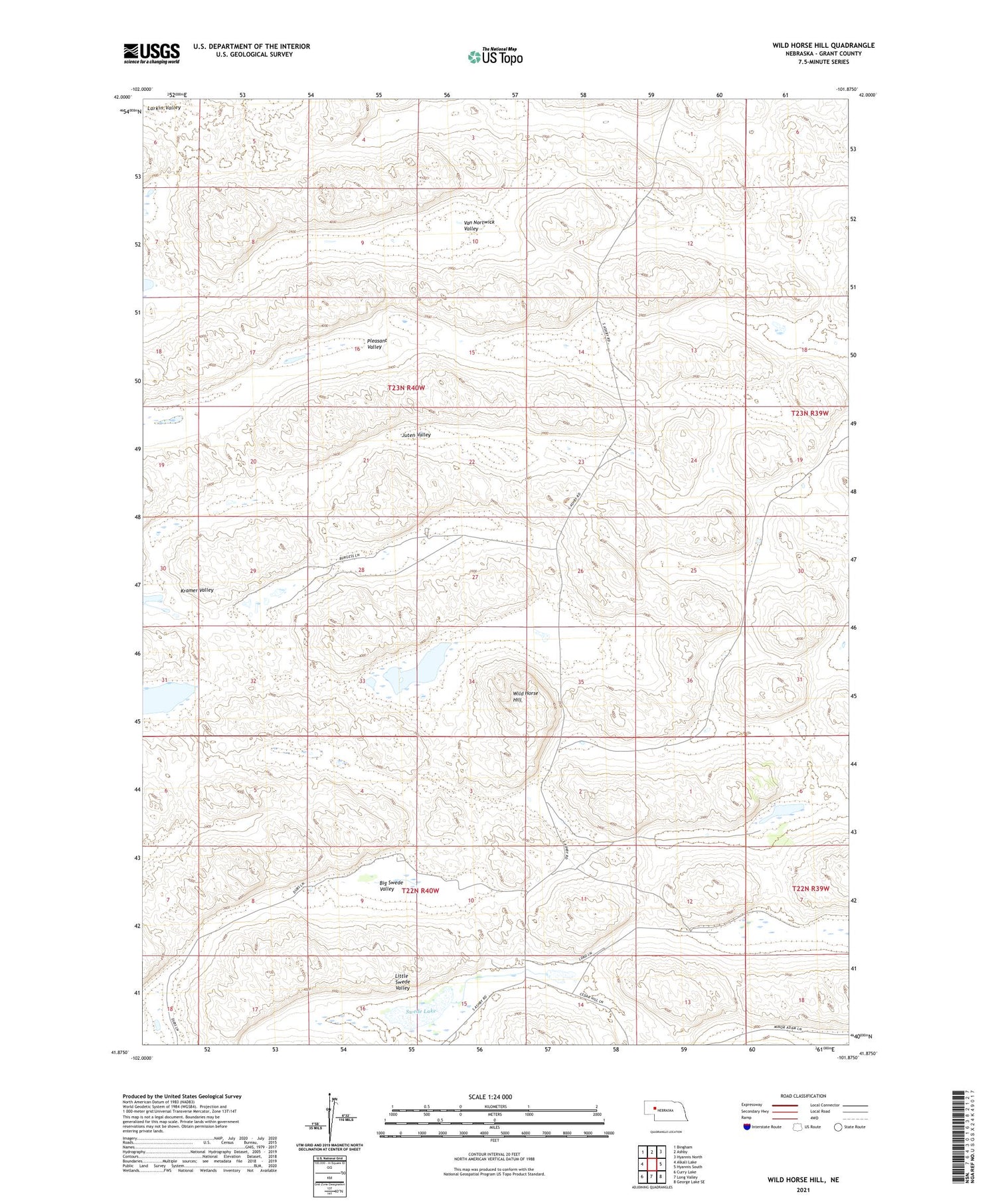
Wild Horse Hill Nebraska US Topo Map
Couldn't load pickup availability
2021 topographic map quadrangle Wild Horse Hill in the state of Nebraska. Scale: 1:24000. Based on the newly updated USGS 7.5' US Topo map series, this map is in the following counties: Grant. The map contains contour data, water features, and other items you are used to seeing on USGS maps, but also has updated roads and other features. This is the next generation of topographic maps. Printed on high-quality waterproof paper with UV fade-resistant inks.
Quads adjacent to this one:
West: Alkali Lake
Northwest: Bingham
North: Ashby
Northeast: Hyannis North
East: Hyannis South
Southeast: George Lake SE
South: Long Valley
Southwest: Curry Lake
Contains the following named places: Arthur Dubs Ranch, Ashby Election Precinct, Big Swede Valley, Burgess Ranch, Juten Valley, Little Swede Valley, Locust School, Pleasant Valley, Rudolph Dubs Ranch, Swede Lake, Van Nortwick Valley, Wild Horse Hill, Willey Ranch


