MyTopo
Hyannis North Nebraska US Topo Map
Couldn't load pickup availability
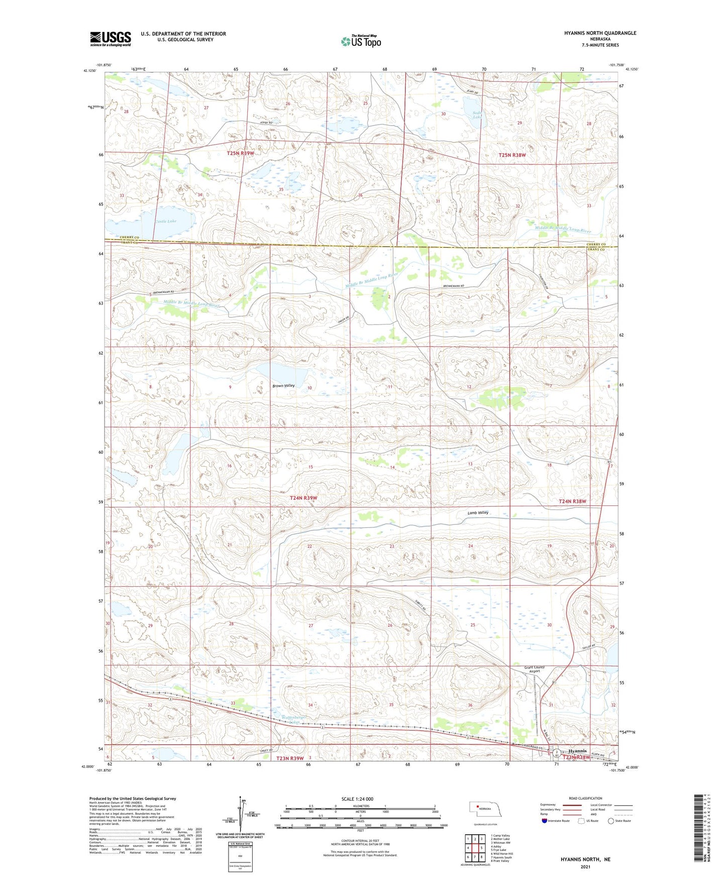
2021 topographic map quadrangle Hyannis North in the state of Nebraska. Scale: 1:24000. Based on the newly updated USGS 7.5' US Topo map series, this map is in the following counties: Grant, Cherry. The map contains contour data, water features, and other items you are used to seeing on USGS maps, but also has updated roads and other features. This is the next generation of topographic maps. Printed on high-quality waterproof paper with UV fade-resistant inks.
Quads adjacent to this one:
West: Ashby
Northwest: Camp Valley
North: Mother Lake
Northeast: Whitman NW
East: Frye Lake
Southeast: Pratt Valley
South: Hyannis South
Southwest: Wild Horse Hill
This map covers the same area as the classic USGS quad with code o42101a7.
Contains the following named places: All Saints Church, Anderson Ranch, B Brenneman Ranch, Brown Valley, Calvary Episcopal Church, Castle Lake, Consolidated School, Davis Ranch, G Brenneman Ranch, Grant County Airport, Grant County Library, Grant County Rescue Squad, Grant County Sheriff's Office, Hayward Ranch, Hyannis, Hyannis Clinic, Hyannis Post Office, J Brenneman Ranch, Klase Ranch, Lamb Valley, Sandhills Fire Protection District, Seventh Day Adventist Church, Sibbit Ranch, Soda Lake, Stevens Ranch, Thurston Ranch, United Church of Christ, Village of Hyannis, Wolfenberger Lakes