MyTopo
Willow Lake Nebraska US Topo Map
Couldn't load pickup availability
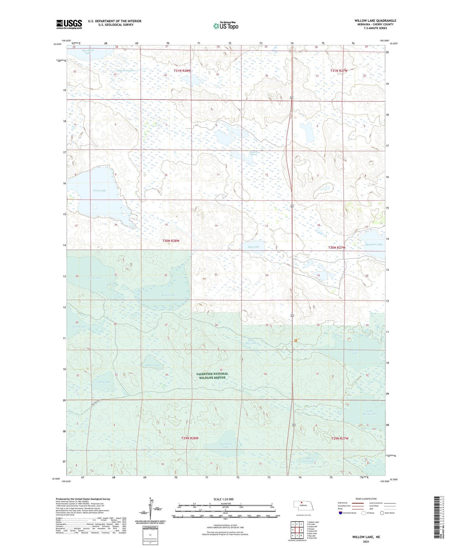
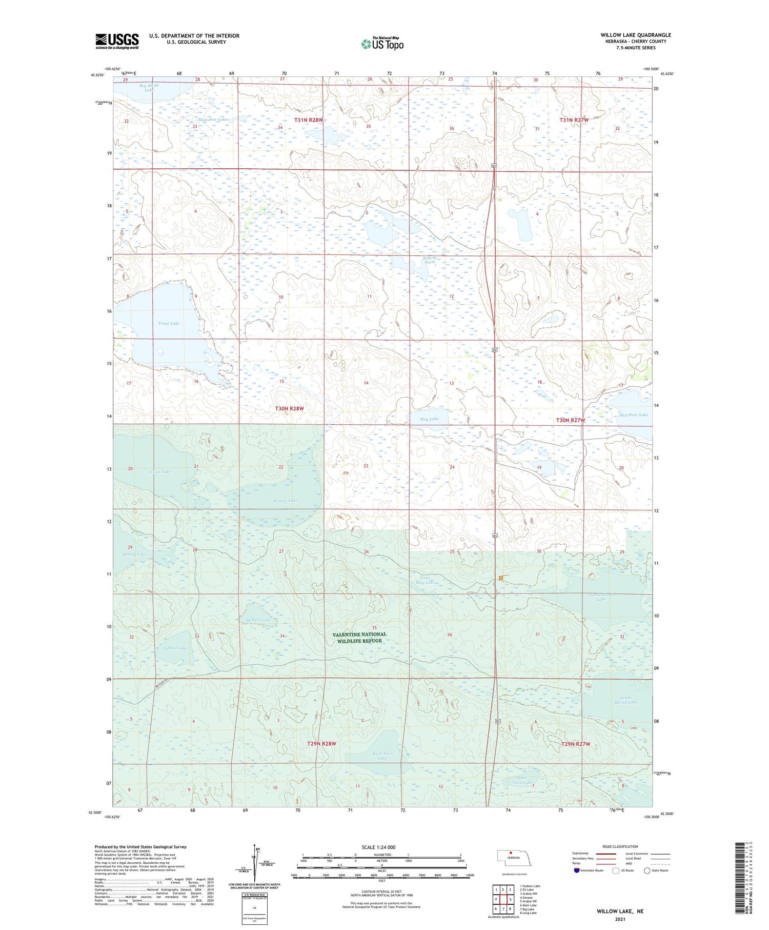
2021 topographic map quadrangle Willow Lake in the state of Nebraska. Scale: 1:24000. Based on the newly updated USGS 7.5' US Topo map series, this map is in the following counties: Cherry. The map contains contour data, water features, and other items you are used to seeing on USGS maps, but also has updated roads and other features. This is the next generation of topographic maps. Printed on high-quality waterproof paper with UV fade-resistant inks.
Quads adjacent to this one:
West: Simeon
Northwest: Hudson Lake
North: Ell Lake
Northeast: Arabia NW
East: Arabia SW
Southeast: Long Lake
South: Big Lake
Southwest: Mule Lake
Contains the following named places: Ballard Marsh Public School, Ballards Marsh, Ballards Marsh State Wildlife Management Area, Clear Lake, Cleveland Election Precinct, East Twin Lake, Harns School, Hay Lake, Little Hay Lake, McKeel Lake, Middle Marsh Lake, Muleshoe Lake, North Marsh Lake, School Lake, South Marsh Lake, Trout Lake, West Twin Lake, Willow Lake, Willow Lake State Wildlife Management Area