MyTopo
Ell Lake Nebraska US Topo Map
Couldn't load pickup availability
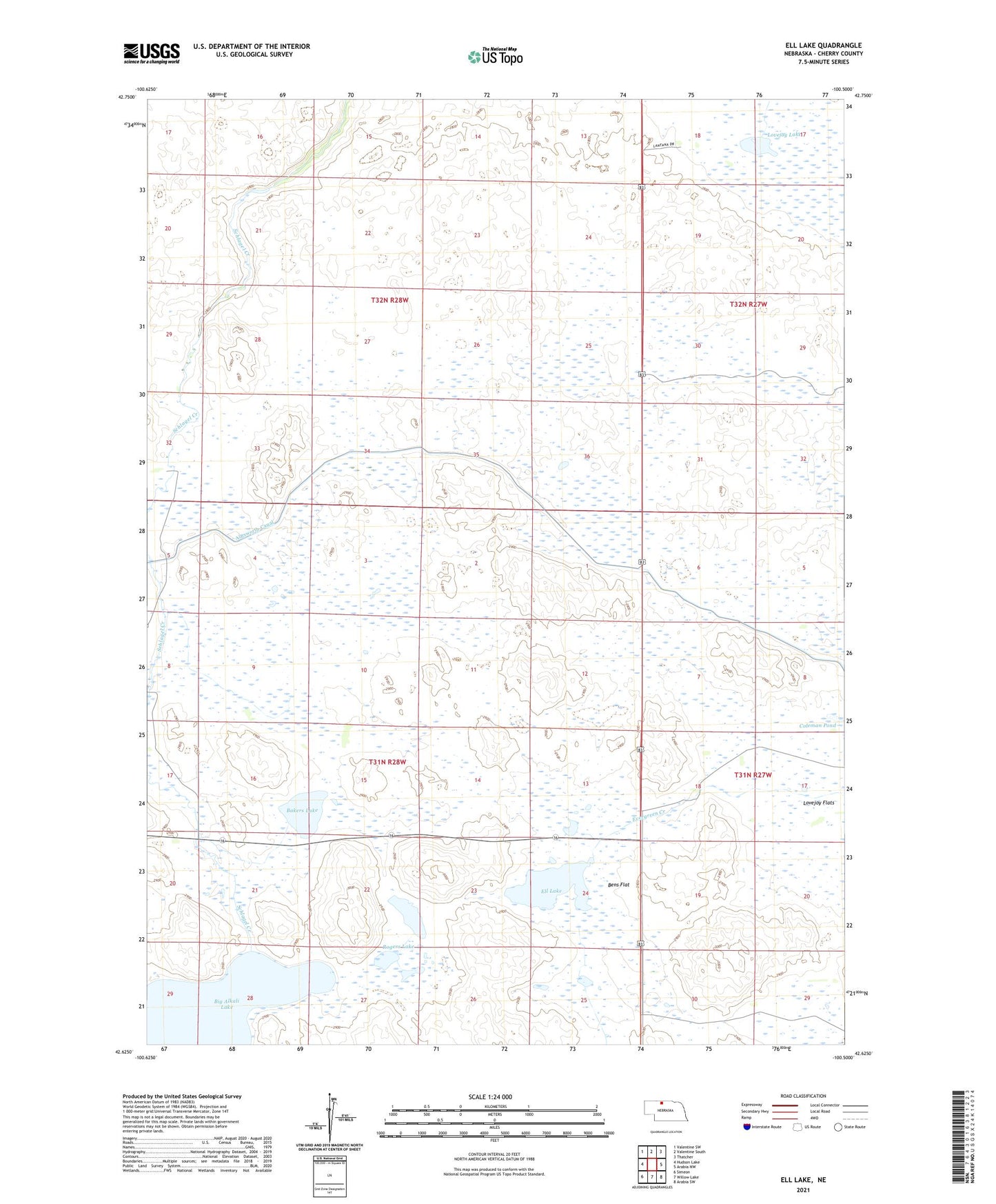
2021 topographic map quadrangle Ell Lake in the state of Nebraska. Scale: 1:24000. Based on the newly updated USGS 7.5' US Topo map series, this map is in the following counties: Cherry. The map contains contour data, water features, and other items you are used to seeing on USGS maps, but also has updated roads and other features. This is the next generation of topographic maps. Printed on high-quality waterproof paper with UV fade-resistant inks.
Quads adjacent to this one:
West: Hudson Lake
Northwest: Valentine SW
North: Valentine South
Northeast: Thatcher
East: Arabia NW
Southeast: Arabia SW
South: Willow Lake
Southwest: Simeon
This map covers the same area as the classic USGS quad with code o42100f5.
Contains the following named places: Baker Ranch, Bakers Lake, Bens Flat, Big Alkali Lake, Big Alkali State Wildlife Management Area, Churchill Ranch, Coleman Pond, Ell Lake, Lovejoy Flats, Lovejoy Lake, Lovejoy Ranch, Miller Ranch, Rogers Lake, Schlagel Creek State Wildlife Management Area, Smith Lake, ZIP Code: 69201