MyTopo
Big Lake Nebraska US Topo Map
Couldn't load pickup availability
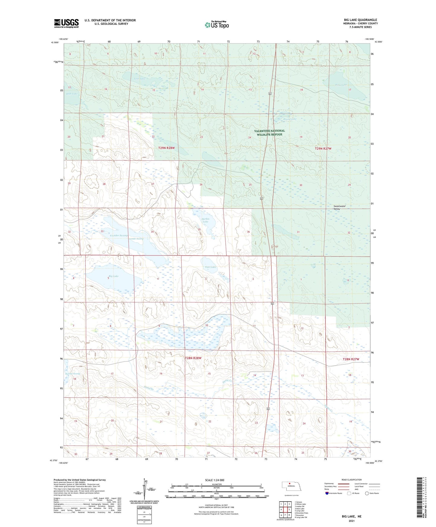
2021 topographic map quadrangle Big Lake in the state of Nebraska. Scale: 1:24000. Based on the newly updated USGS 7.5' US Topo map series, this map is in the following counties: Cherry. The map contains contour data, water features, and other items you are used to seeing on USGS maps, but also has updated roads and other features. This is the next generation of topographic maps. Printed on high-quality waterproof paper with UV fade-resistant inks.
Quads adjacent to this one:
West: Mule Lake
Northwest: Simeon
North: Willow Lake
Northeast: Arabia SW
East: Long Lake
Southeast: Long Lake SW
South: Brownlee
Southwest: Brownlee Flats
This map covers the same area as the classic USGS quad with code o40095a3.
Contains the following named places: Big Lake, Campbell Lake, Cow Lake, Durbin Lake, Homestead Lake, J Lee Ranch, Lost Lake, Pony Lake, Round Lake, School Number 127, Sweetwater Valley, Tate Lake, Valentine National Wildlife Refuge, Vian Ranch, Vrender Swamp