MyTopo
Simeon Nebraska US Topo Map
Couldn't load pickup availability
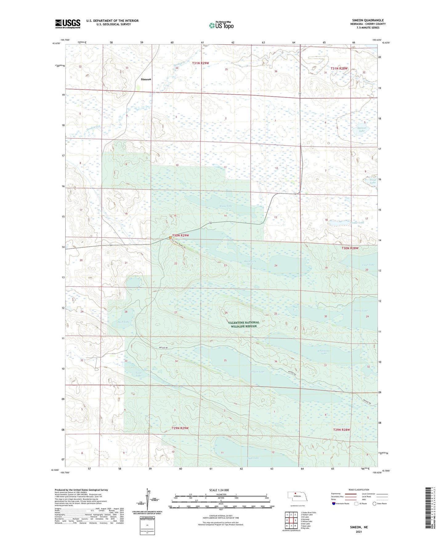
2021 topographic map quadrangle Simeon in the state of Nebraska. Scale: 1:24000. Based on the newly updated USGS 7.5' US Topo map series, this map is in the following counties: Cherry. The map contains contour data, water features, and other items you are used to seeing on USGS maps, but also has updated roads and other features. This is the next generation of topographic maps. Printed on high-quality waterproof paper with UV fade-resistant inks.
Quads adjacent to this one:
West: Kennedy
Northwest: Snake River Falls
North: Hudson Lake
Northeast: Ell Lake
East: Willow Lake
Southeast: Big Lake
South: Mule Lake
Southwest: Bull Lake
This map covers the same area as the classic USGS quad with code o42100e6.
Contains the following named places: Cedar Lake, Dewey Lake, Duck Lake, Duck Lake School, Hackberry Lake, Long Lake, Lookout Tower Number 1, Pelican Lake, School Number 109, Simeon, Simeon Post Office, Spencer Lake, Watts Lake, Whitewater Lake