MyTopo
Wymore Nebraska US Topo Map
Couldn't load pickup availability
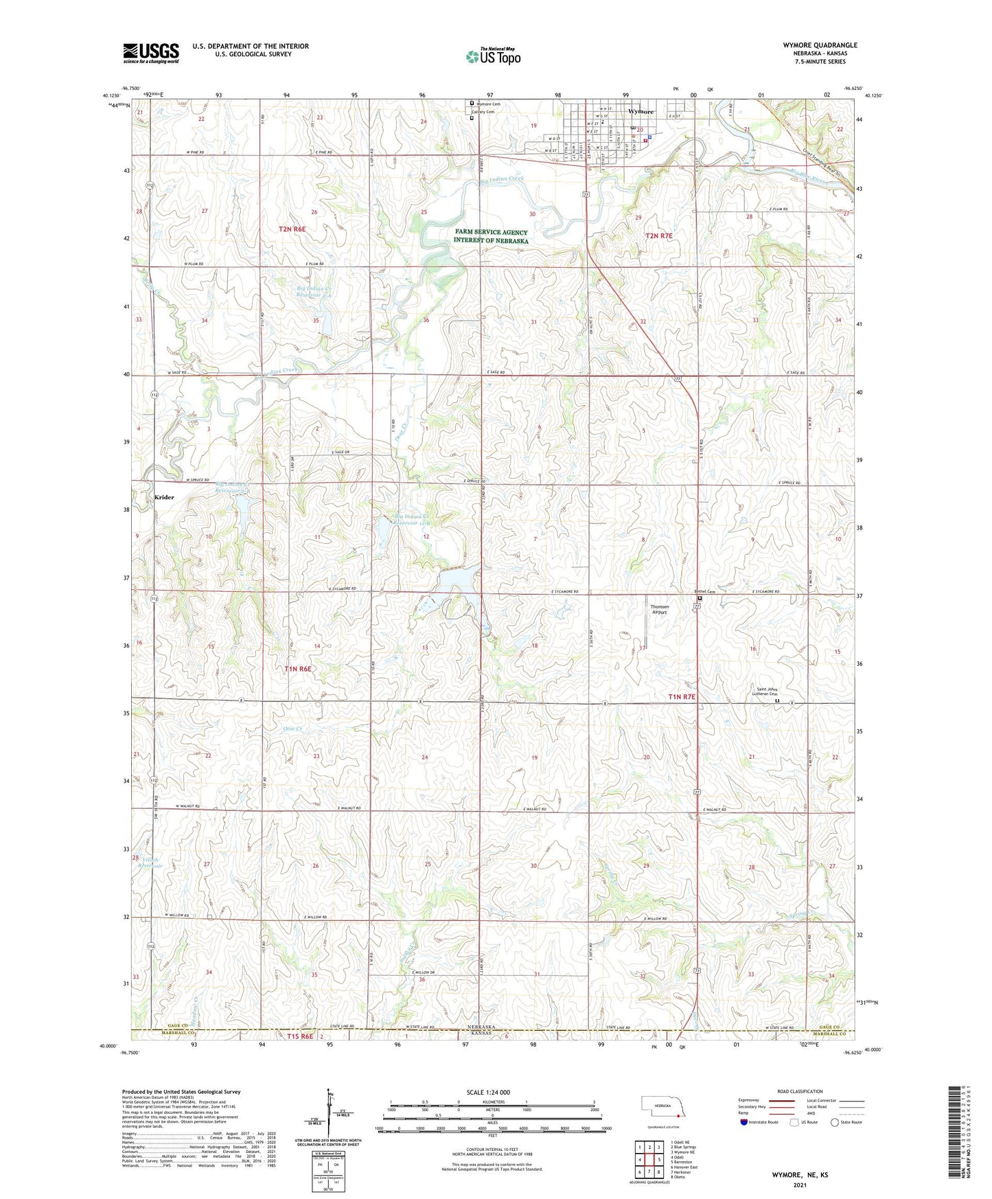
2021 topographic map quadrangle Wymore in the state of Nebraska. Scale: 1:24000. Based on the newly updated USGS 7.5' US Topo map series, this map is in the following counties: Gage, Marshall. The map contains contour data, water features, and other items you are used to seeing on USGS maps, but also has updated roads and other features. This is the next generation of topographic maps. Printed on high-quality waterproof paper with UV fade-resistant inks.
Quads adjacent to this one:
West: Odell
Northwest: Odell NE
North: Blue Springs
Northeast: Wymore NE
East: Barneston
Southeast: Oketo
South: Herkimer
Southwest: Hanover East
Contains the following named places: Bethel Cemetery, Big Indian Creek, Big Indian Creek Dam 11-A, Big Indian Creek Dam 11-B, Big Indian Creek Dam 2-A, Big Indian Creek Dam 2-B, Big Indian Creek Reservoir 11-A, Big Indian Creek Reservoir 11-B, Big Indian Creek Reservoir 2-A, Big Indian Creek Reservoir 2-B, Calvary Cemetery, City of Wymore, Community Physicians Clinic, Immanuel State Line Lutheran Church, Krider, Otoe Creek, Saint Johns Lutheran Cemetery, Saint Josephs Catholic Church, Saint Peters Lutheran Church, Sicily Creek, Southern High School, Thomsen Airport, Township of Barneston, Township of Paddock, United Methodist Church, Vitosh Reservoir, Wymore, Wymore Cemetery, Wymore Country Club, Wymore Good Samaritan Center, Wymore Medical Clinic, Wymore Police Department, Wymore Post Office, Wymore Public Library, Wymore Volunteer Fire and Rescue Department, ZIP Code: 68466